

Can you identify these seven American landscapes?
I play Geoguessr competitively. If you're not familiar: Geoguessr drops you into a random Google Street View image somewhere in the world and asks you to guess where you are. No clues except the image itself.
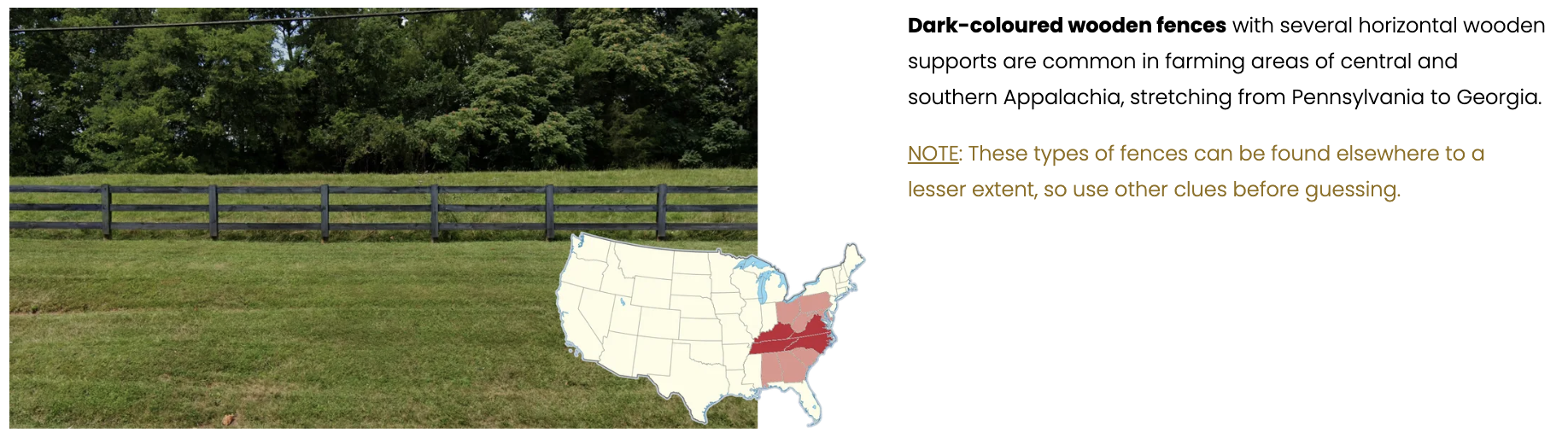
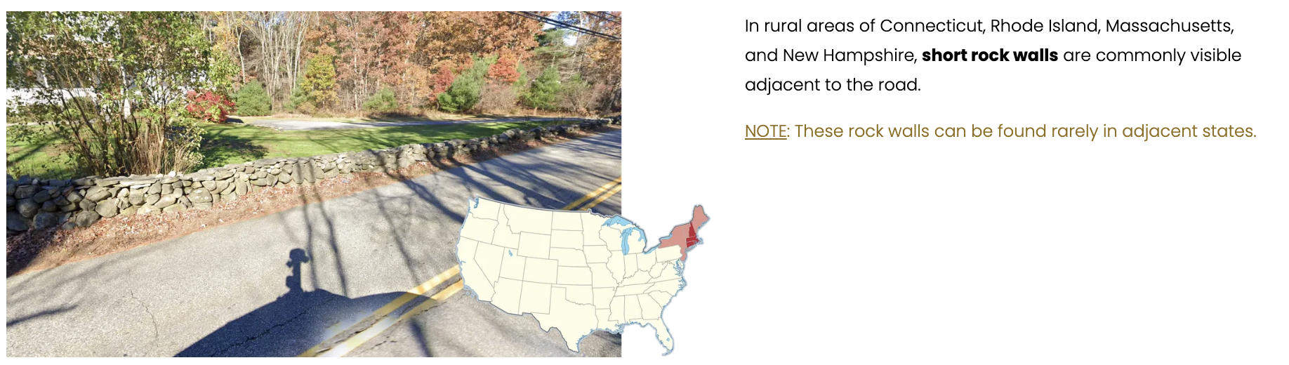
I've been playing for almost two years. And after a while, you develop this ability to glance at a Street View image and know — from a dark brown wooden fence, or a short stone wall next to a shingled house — that you're looking at Virginia or coastal New England.
Try it below. I made a mini-geoguessr with seven Street View images from the United States.
How well do you know
American landscapes?
You'll see seven Google Street View images from across the United States. Click the map to guess where each photo was taken. Let's see how close you can get.
Here's the thing about Geoguessr: everyone I play against is also obsessed with this stuff. That's not a normal population. That's a self-selected group of geography nerds.
I spend my other life — my actual job — thinking about the exact opposite kind of person. The average American survey respondent. Someone on their couch, half-watching TV, answering my questions.
Two worlds. One where I stare at a Street View image and try to figure out where I am. Another where I stare at a spreadsheet and try to figure out what other people think.
So at some point the question became obvious: How well do regular people play GeoGuessr? Not competitive Geoguessr players. Just the kind of people who take my surveys. If you show someone in Iowa a picture of a flat road cutting through a corn field, do they feel it in their gut?
I had to find out. So I took those same seven images and put them in front of roughly 286 survey respondents. I couldn't ask them to pinpoint a location on a map, so instead I asked questions like: 'Do you see a lot of short rock walls and shingle-sided homes in the part of the country you live in?'
Here's what I found.
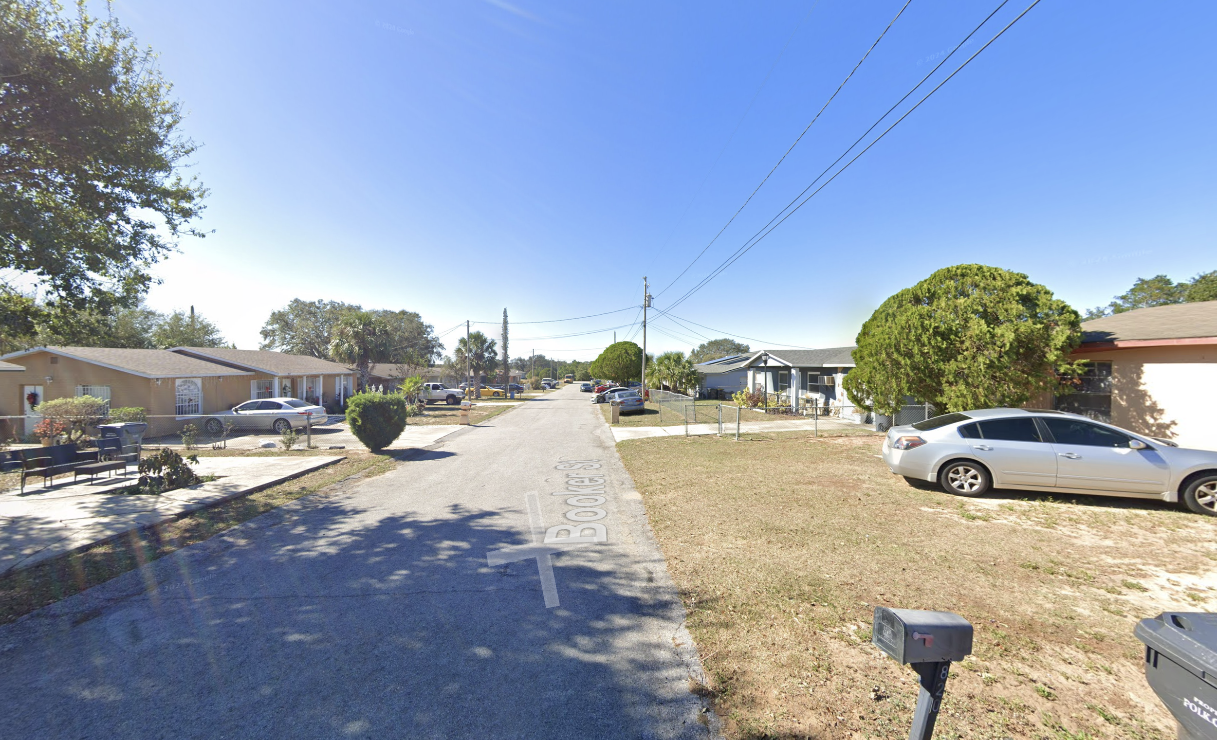
Central Florida
Below you can see the results for the first image: central Florida.
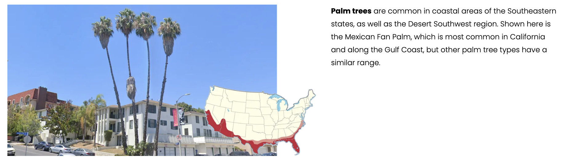
I showed respondents the Street View image and asked, "Could you walk around your local area and see palm trees likes the ones above?" Sure enough, respondents who live in Florida and along the Gulf Coast were far more likely to say yes — those are the green dots.
The yeses trace the southern coast from Florida to Texas, sweep through the Desert Southwest, and climb up the Pacific coast. If you pull up a distribution map of palm trees in the United States (which I did with a screenshot from PlonkIt.com) it looks almost identical.
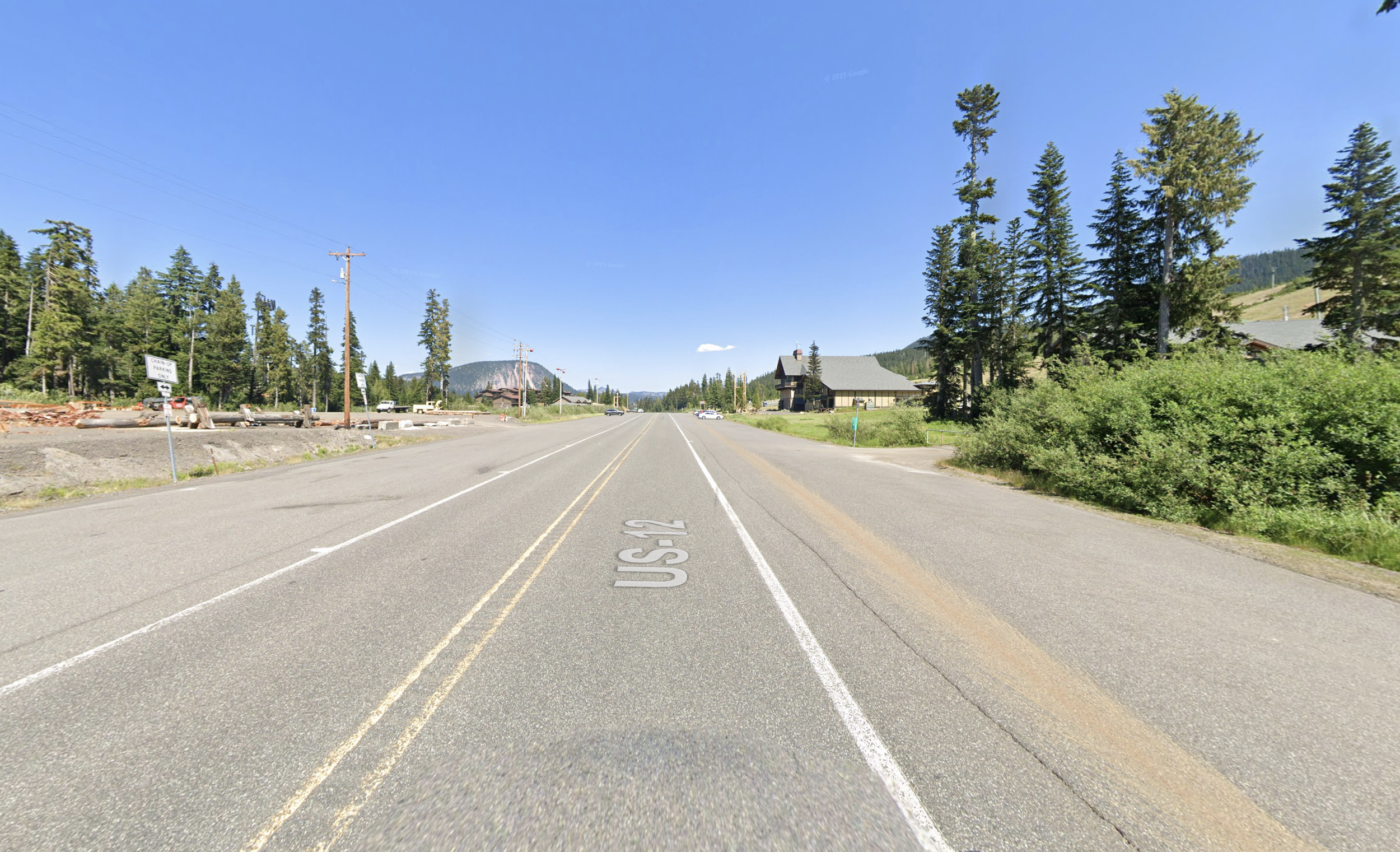
Washington State
For this one I asked respondents if they see "big mountains, tall pines, and open air" — and almost everyone in the Pacific Northwest got it right. Green dots across Washington, Oregon, and Montana.
But there are two other hotspots worth noticing. One is the Front Range in Colorado — no surprise there, those respondents are staring at the Rockies every day. The other is the Appalachian corridor, from Pennsylvania down into North Carolina. Those respondents also said yes, and they're not wrong — they do see mountains. Just not the same kind.
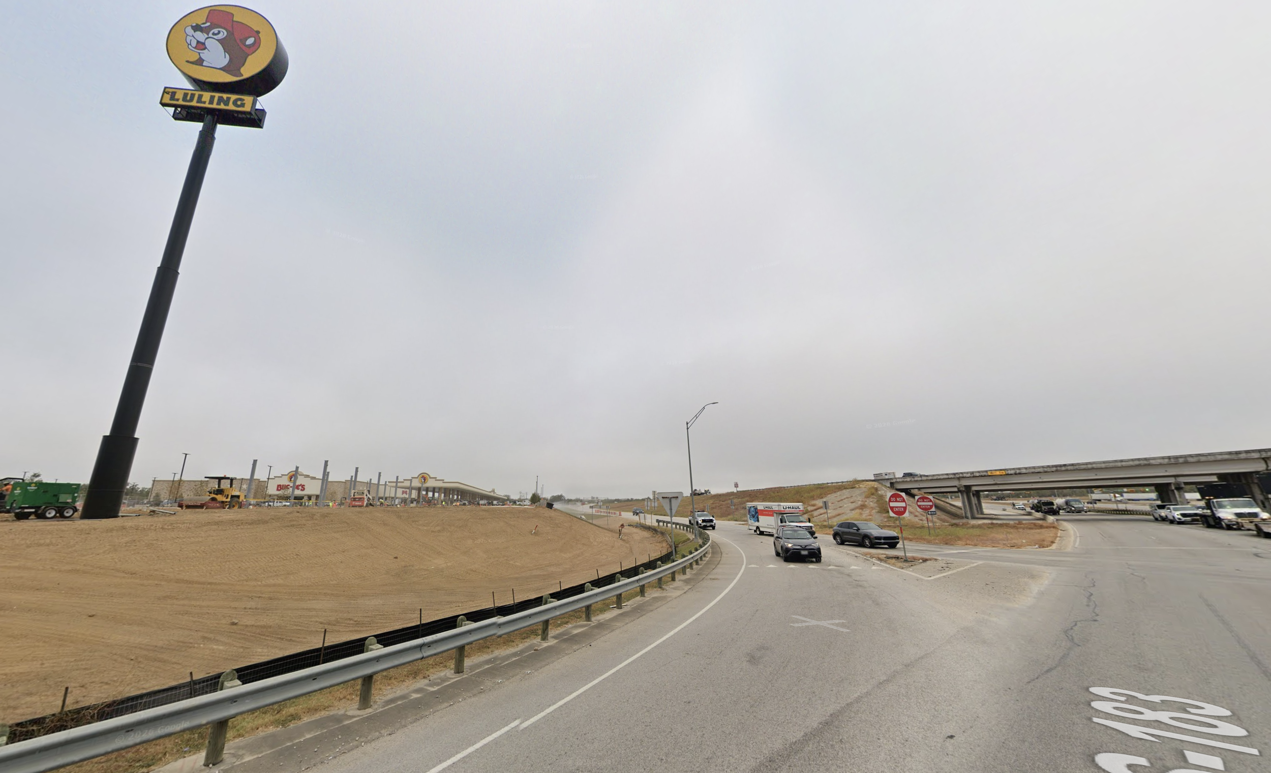
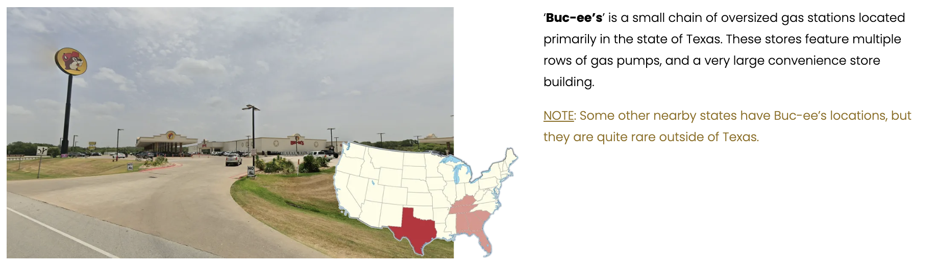
Texas
Texas was fun. Buc-ee's is a regional gas station chain — massive locations, mostly in Texas but expanding into parts of the South. You can see one in the Street View image below.
The green dots cluster generally where you'd expect. Around Texas, the pattern gets fuzzier. There’s a wide ring of “not sure” responses in nearby states—places where Buc-ee’s feels close, even if it isn’t. Myabe that's brand awareness creeping in. I'm not sure. Still, the green dots trace the company’s real expansion into the Southeast, and within Texas itself, the answers are almost uniformly correct.
Southwest California
Most people don’t think they can get into their car and drive to a landscape like this within a few hours—and for much of the country, they’re right. The map turns red quickly as you move east of the Mississippi, where a “few hours’ drive” won’t land you in anything close to this kind of landscape.
Out West, where environments like this are actually accessible, you start to see more green. It’s not perfect, but the overall pattern tracks with reality: people in the right parts of the country are more likely to say yes, and people in the wrong parts are more likely to say no.
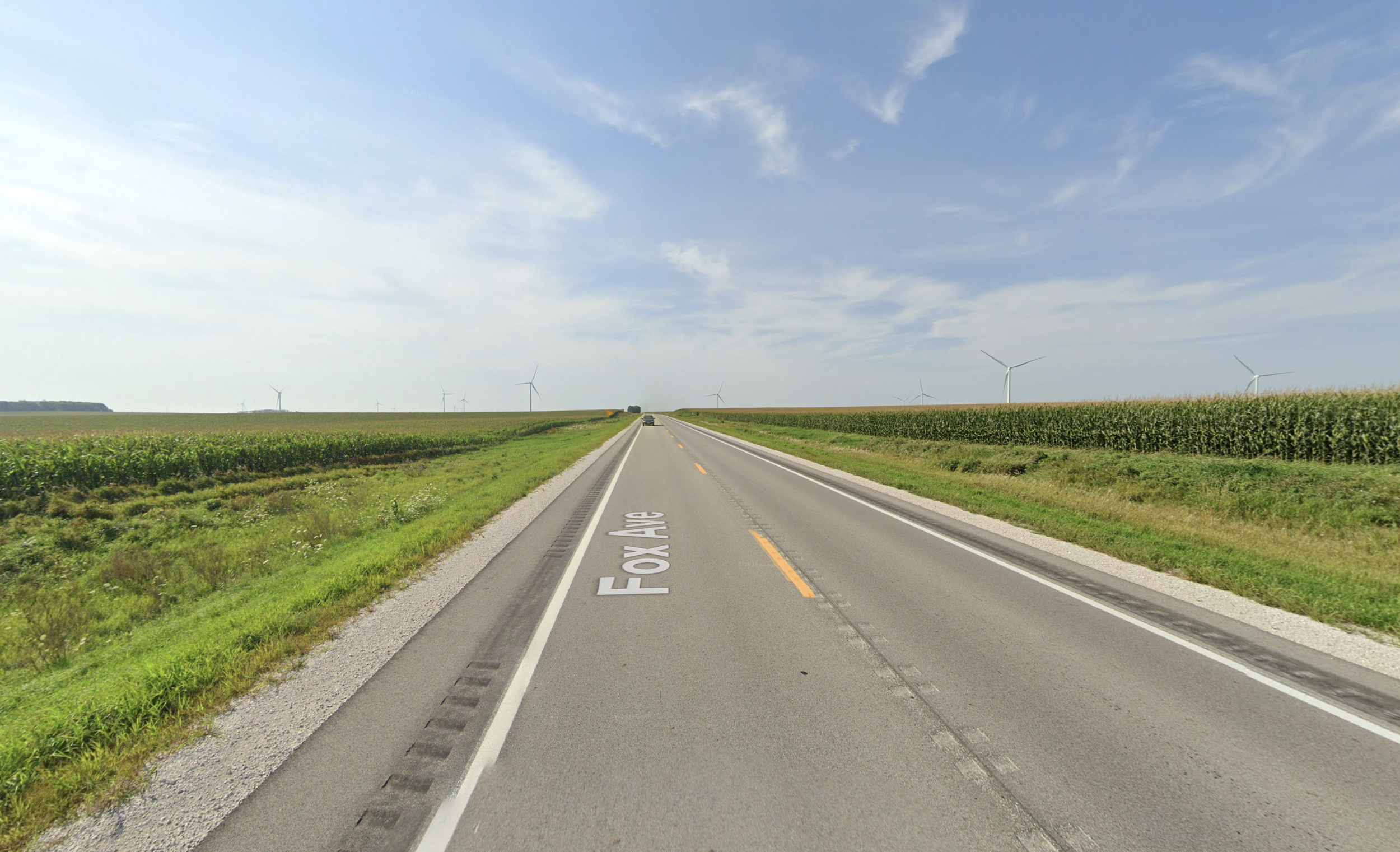
Iowa
The Iowa image surprised me. I expected the yeses to stay tight on the Great Plains, but the green dots spread much further — through the Mid-Atlantic, parts of Texas, all over.
It speaks to the enormous amount of corn the United States grows, not just in Iowa and Nebraska but practically everywhere. I think it takes a trained eye to look at a flat field of corn and say that's specifically Iowa. To most people, corn is corn.

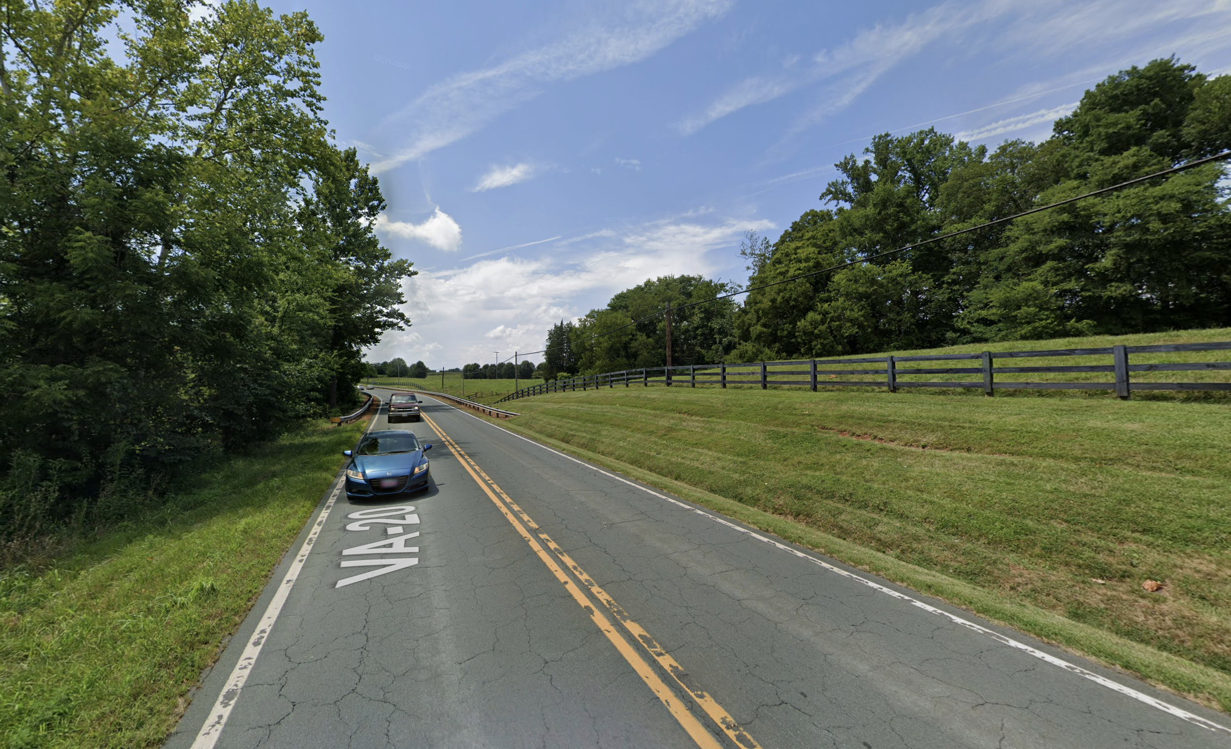
Virginia
The Mid-Atlantic was the hardest. The question asked about "gently rolling hills and dark-colored wooden fences" — which, if you play Geoguessr, is a known tell for Virginia and the central Appalachian farming regions.
But the results were messy. Green and red dots mixed together across the eastern half of the country. Turns out, a lot of Americans think they live near rolling hills and dark fences. It's a less distinctive visual signature than a palm tree or a mountain range.
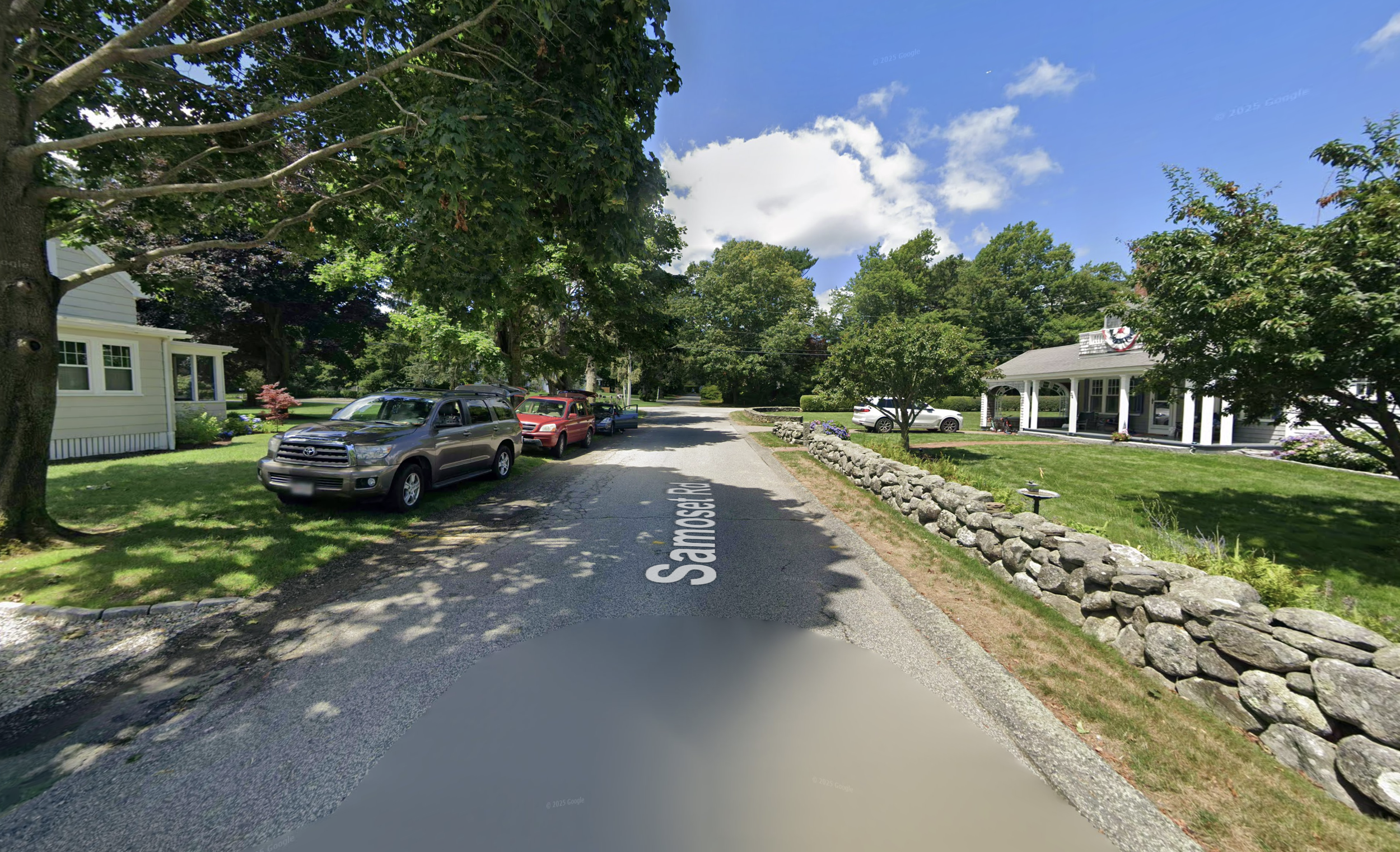
New England
Short rock walls is one of the most reliable regional tells in the United States. Yes, you can find rock walls in other parts of the country, but combine them with dense forest, an uneven landscape, and shingle-sided homes, and you're likely looking at New England. It's not a 100% lock, which explains why some respondents from other parts of the country also said yes. But it's close.
That's it! Across all seven images, the pattern is pretty consistent. People aren’t perfect, but they have a decent sense of what’s around them—and just as importantly, what isn’t. When you ask the right kind of question, that mental map shows up clearly.