How I became a GeoGuessr champion while raising three kids under six
A data-driven story about beating unmarried, childless Gen Z geography nerds at their own game.
In the summer of 2024, I had a bad habit. Every morning when I got to my office, I'd watch YouTube while I ate breakfast. When I finished eating, I'd watch for another 20 minutes. Then I'd start work. That's about 45 minutes every morning lost to the Internet.
During one of these binges, I came across a WIRED video of GeoGuessr player Trevor Rainbolt explaining his guesses. If you're not familiar: GeoGuessr drops you into a random Google Street View image somewhere in the world and asks you to guess where you are.
I've always loved geography, so I paid the $1.99 subscription fee and swapped YouTube for GeoGuessr.
Two years later, I had risen to become the 354th ranked player in the world – out of roughly 40,000 – and in the United States.
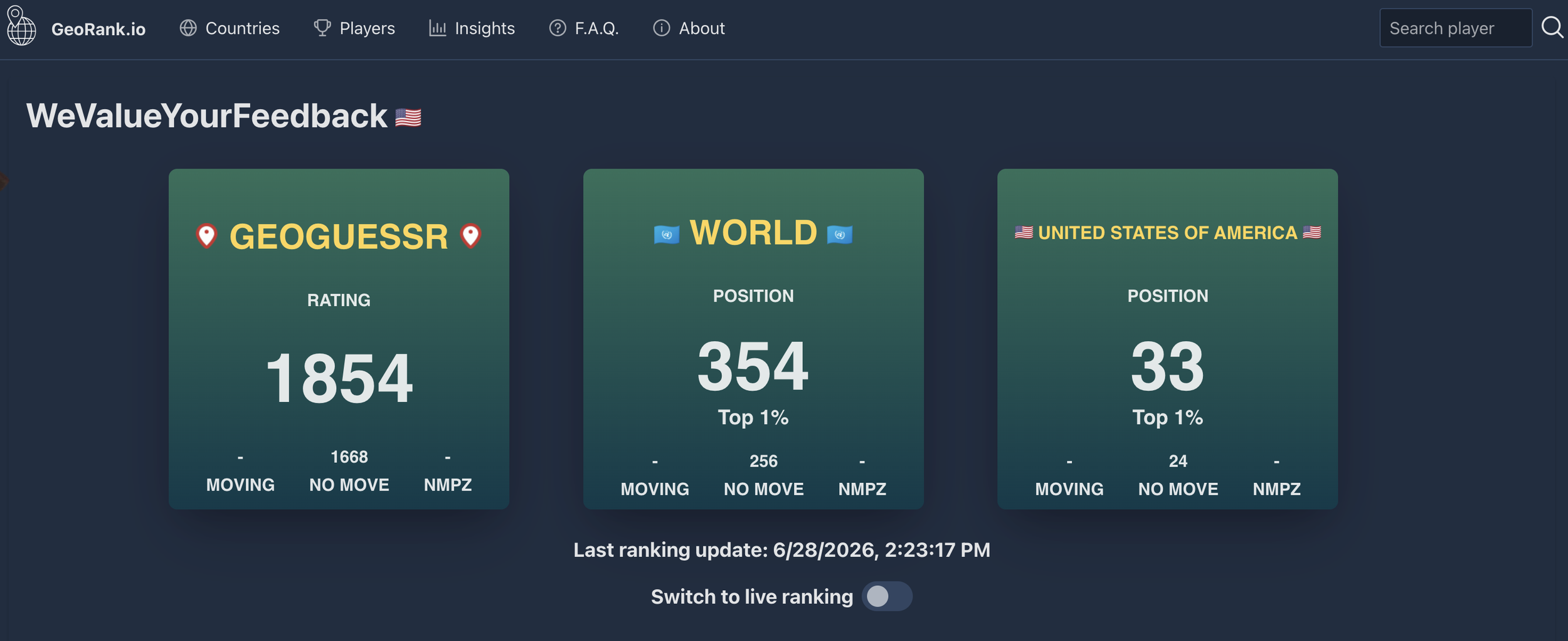
That in itself isn't that impressive. The tier above me — the nerds headed to the GeoGuessr World Cup in August — could easily beat me. What's impressive is that I got there while running my own consultancy and raising two young kids, with a third arriving right at the end of my run.
This is a story about how I used forty-five minutes before work to close the gap on Gen Z geography nerds with all day to practice.
It's also a story about what happened the night I finally hit my highest ranking — and why, a few days later, I quit trying entirely.
From Bronze to Champion: June ‘24 – Dec. ‘24
You can get pretty good at GeoGuessr without ever competing. You just play for fun. Competitive GeoGuessr is something else entirely. In a duel, two players face the same location at the same time and both guess where it is. Closer wins the round. Do that over several rounds and someone gets knocked out.
Like a soccer pyramid, everyone in competitive GeoGuessr starts in the lowest league and gets promoted or relegated based on their standing at the end of the week. I entered at the bottom, Bronze I (there were only 10 leagues when I started), thinking that I'd earn a promotion or two at best.
| Division | Promotion | Relegation |
|---|---|---|
| Champion | – | 13% |
| Master I | 10% | 13% |
| Master II | 13% | 13% |
| Gold I | 13% | 16% |
| Gold II | 16% | 13% |
| Gold III | 20% | 10% |
| Silver I | 36% | 13% |
| Silver II | 50% | 13% |
| Silver III | 50% | – |
| Bronze | 70% | – |
But I climbed the pyramid fast, promoted five weeks straight. I'd study in the morning and use a second window from 4:30 to 5pm — right before I picked up my kids — to play a few duels. I never played on weekends. With kids, that wasn't an option.
I had a good system. After every duel, I'd examine my guesses and check Plonkit.net — a community-built site with country-specific guides — to see if I'd missed a clue.
Here's one miss. I guessed Czechia but the correct answer was Denmark. Scroll through and see four clues that gave it away — the same ones I missed in real time.
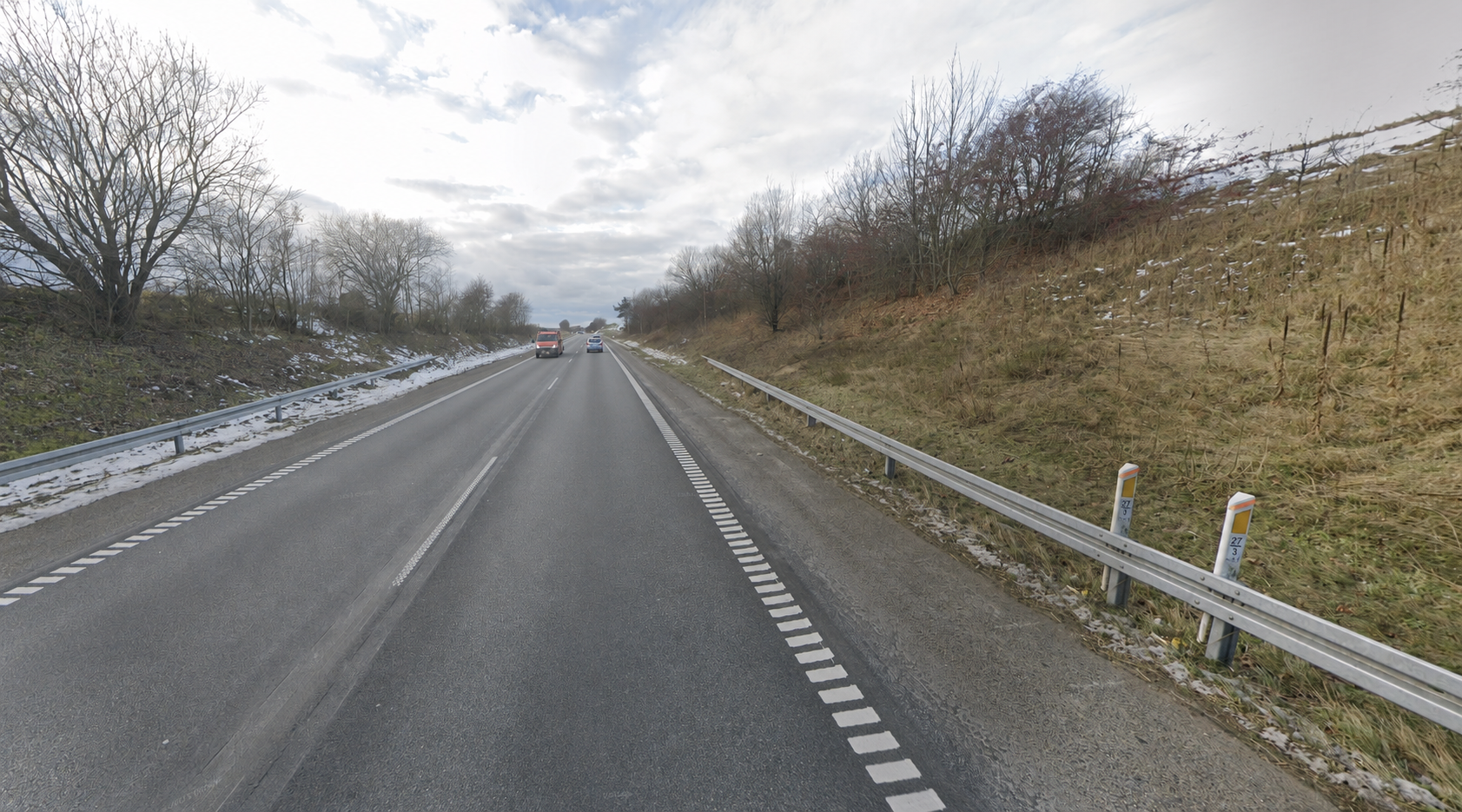
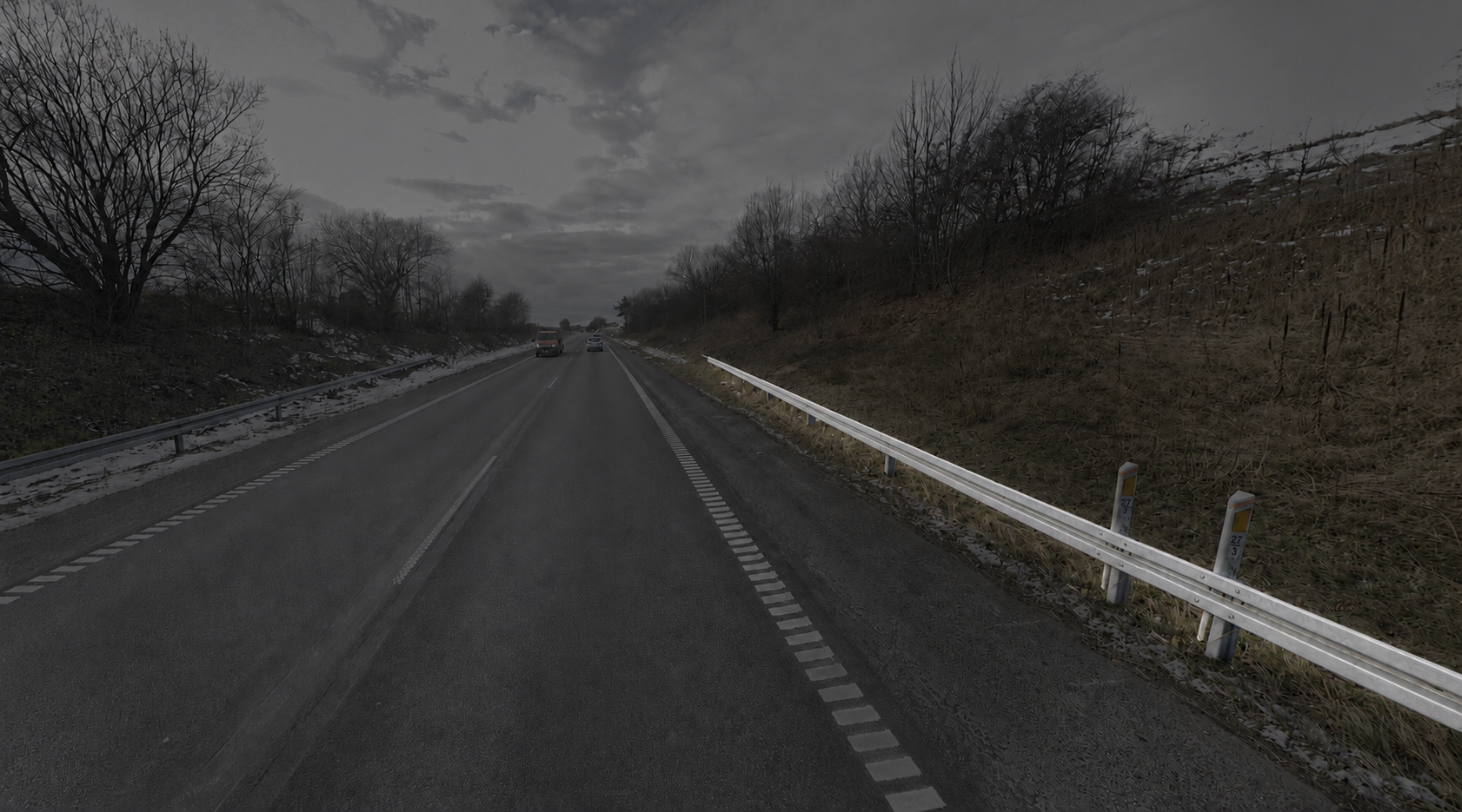
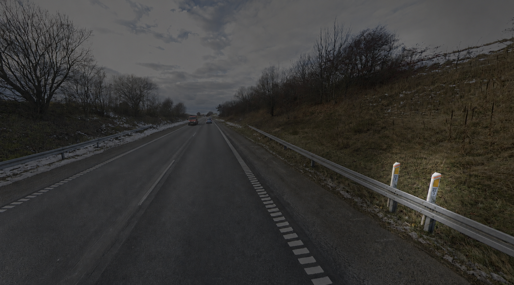
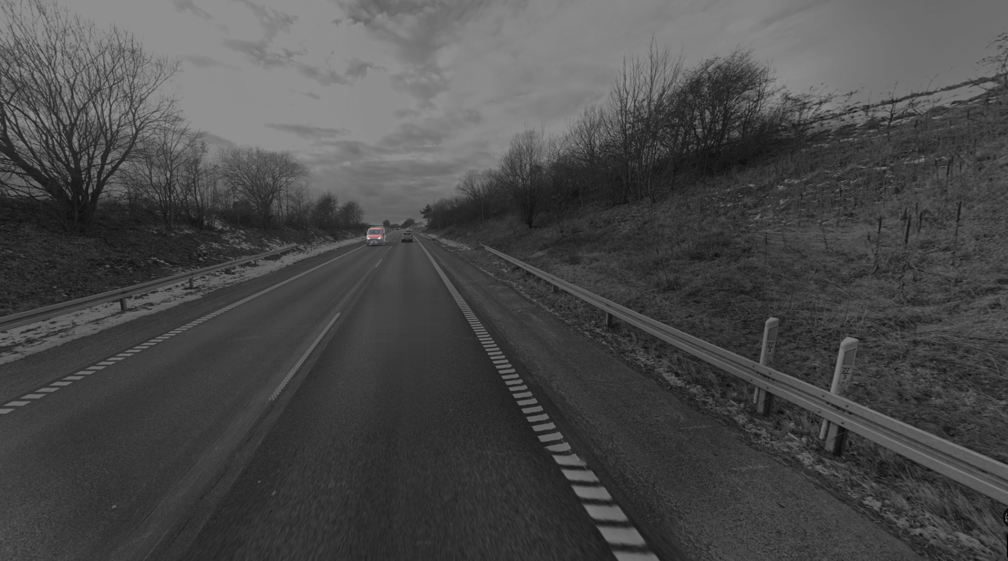
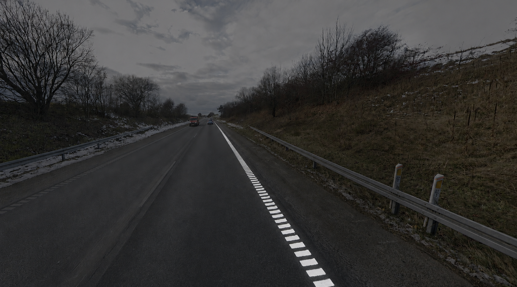
B-type guardrails. Denmark is one of just eight European countries using this design — the GeoGuessr community nicknamed it "B-type."
The bollard. White post, yellow reflector, orange stripe. This exact combination exists nowhere else on Earth.
Dashed outer white lines. It varies by region, but outer road lines in Denmark often consist of small white squares.
Yellow plates on trucks. Like most European countries, standard plates in Denmark are long and white, with a blue strip on the left. However, plates on commercial vehicles are yellow.
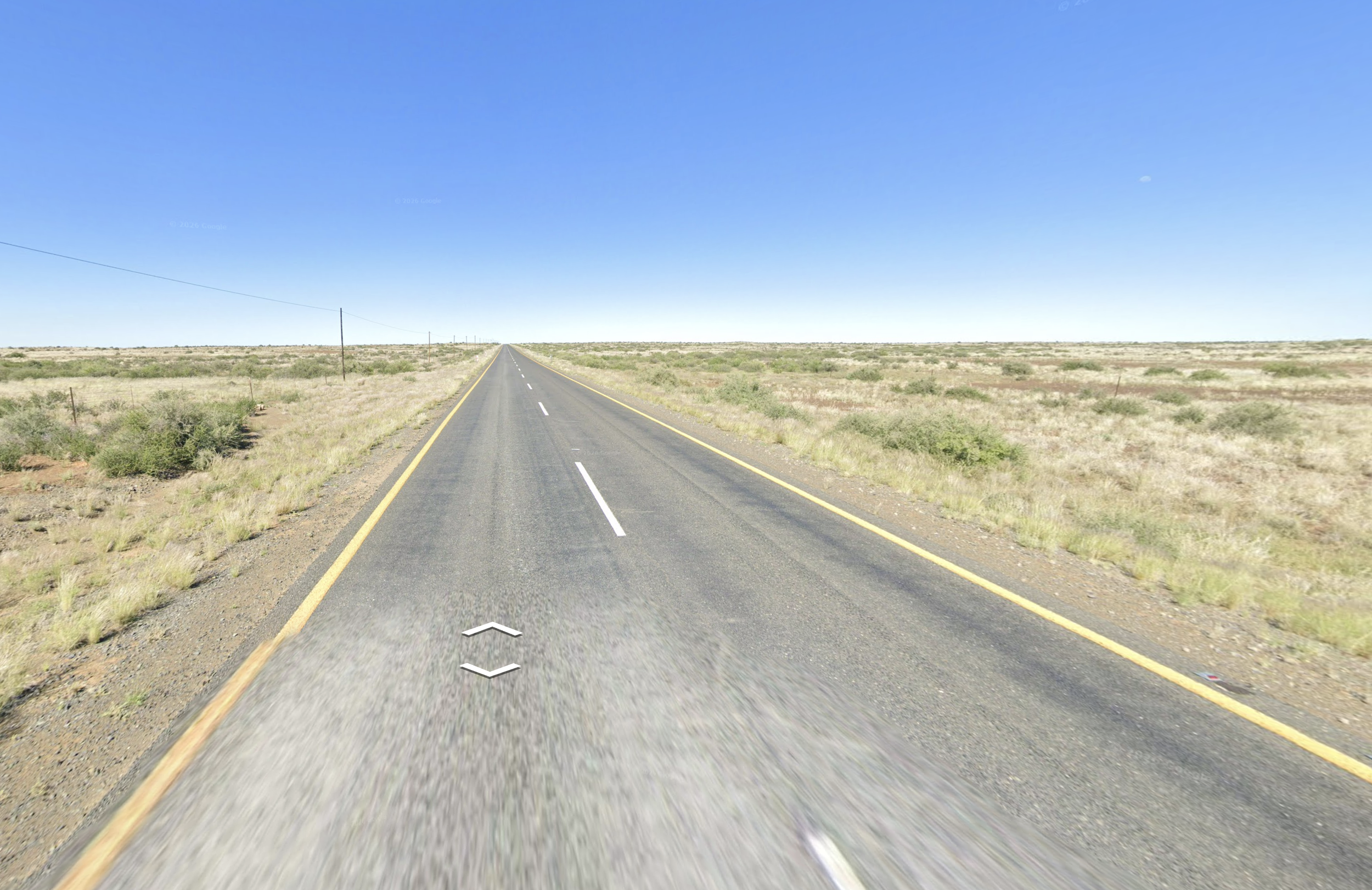
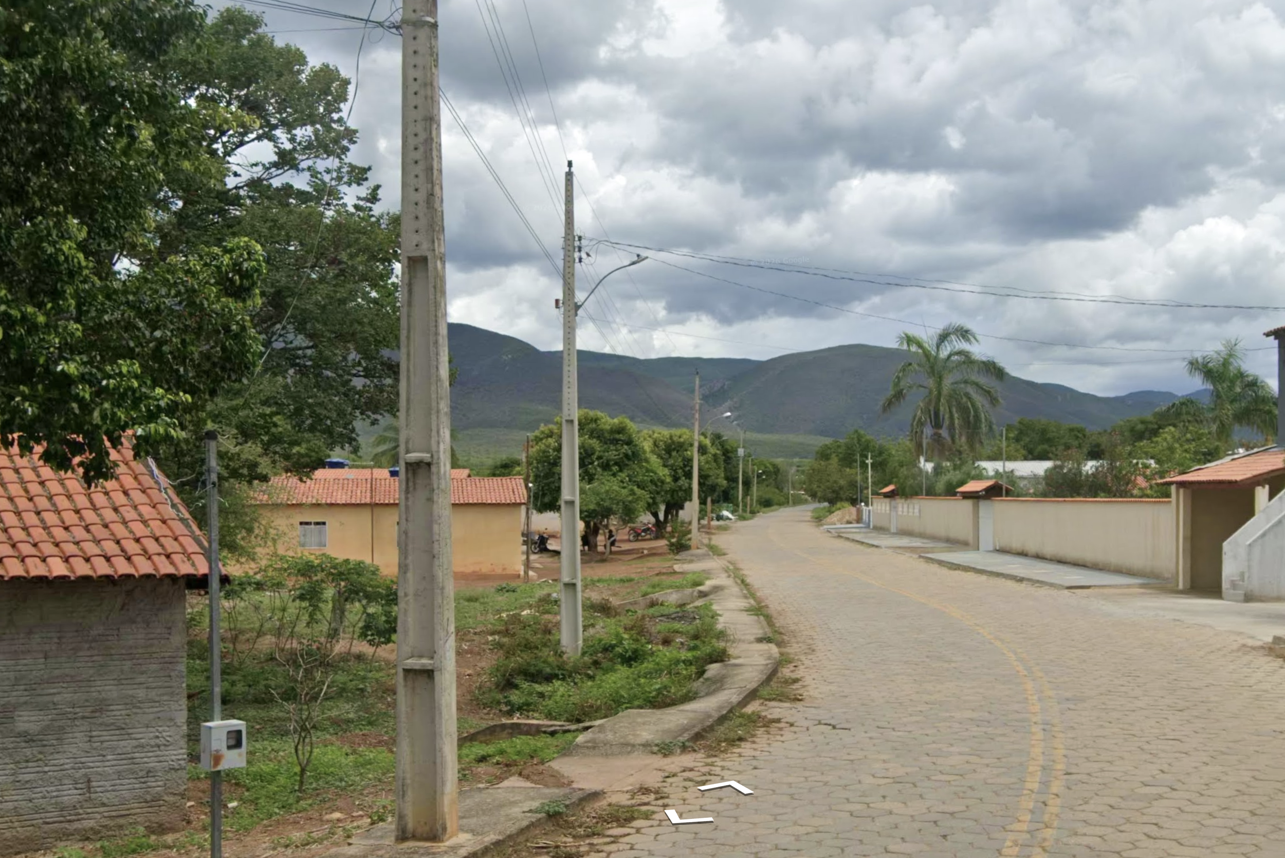
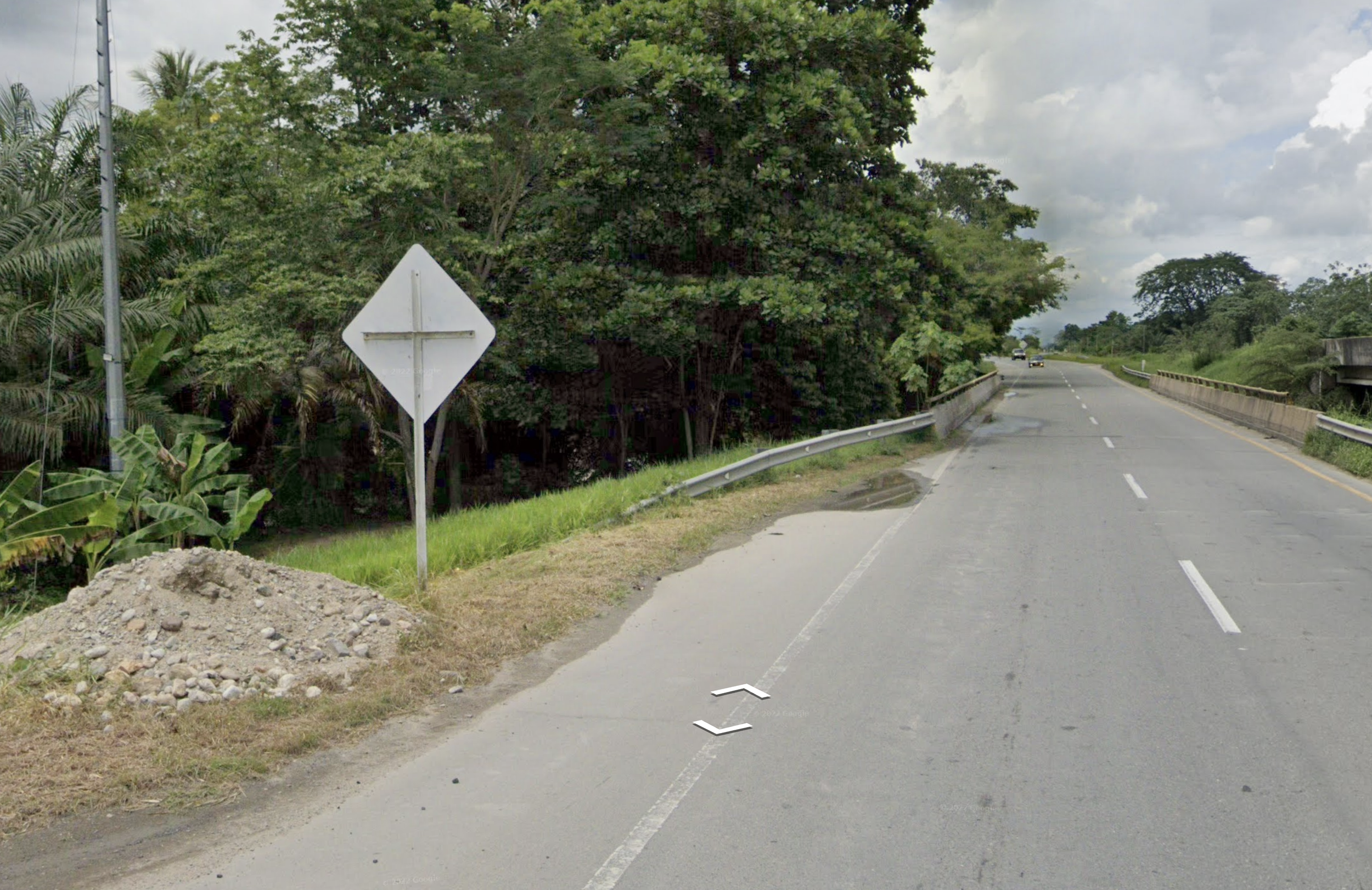
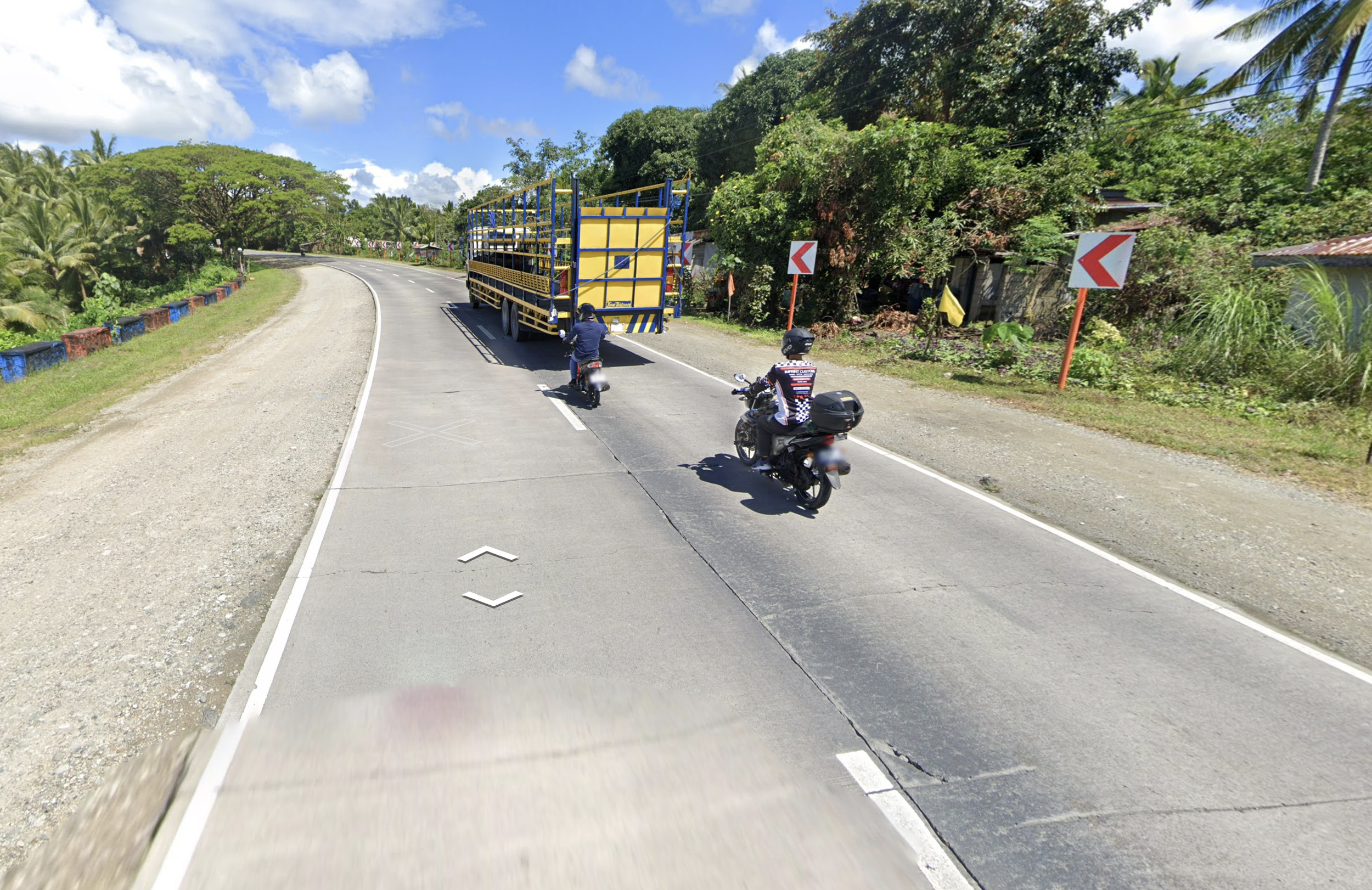
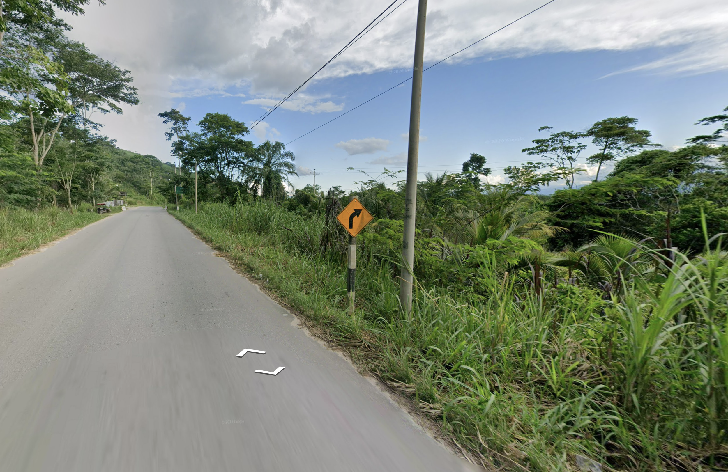
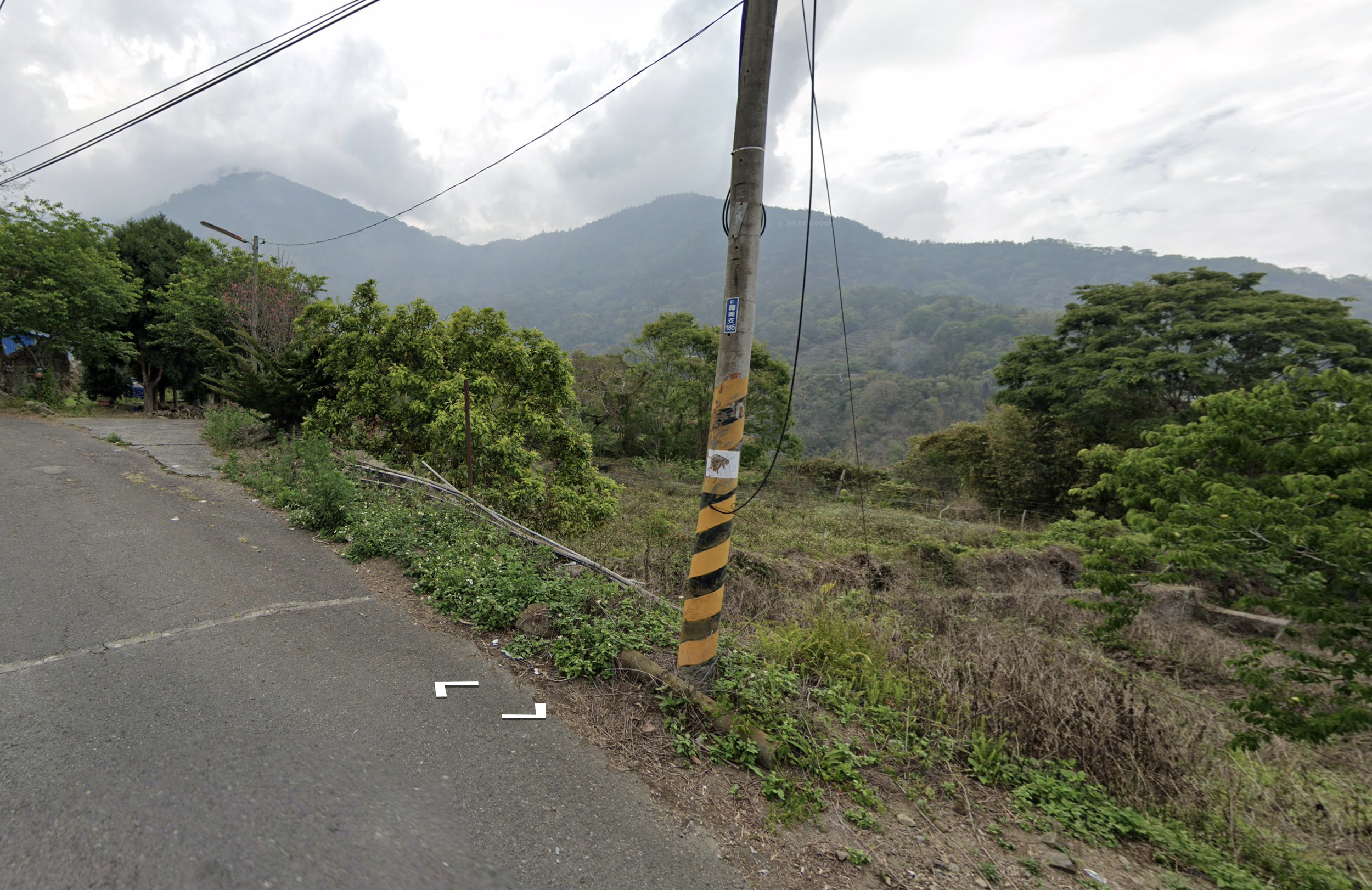
Every country has clues that I’d screenshot and drop into a Keynote I create.
- Outer yellow lines in South Africa
- Ladder poles in Brazil
- The Colombian cross
- Concrete roads in Philippines
- Black & white sign posts in Peru
- Taiwanese pole reflectors
After a few weeks of seeing clues in practice rounds and duels, these clues started to stick. It was like shuffling through the world’s most interesting set of flashcards.
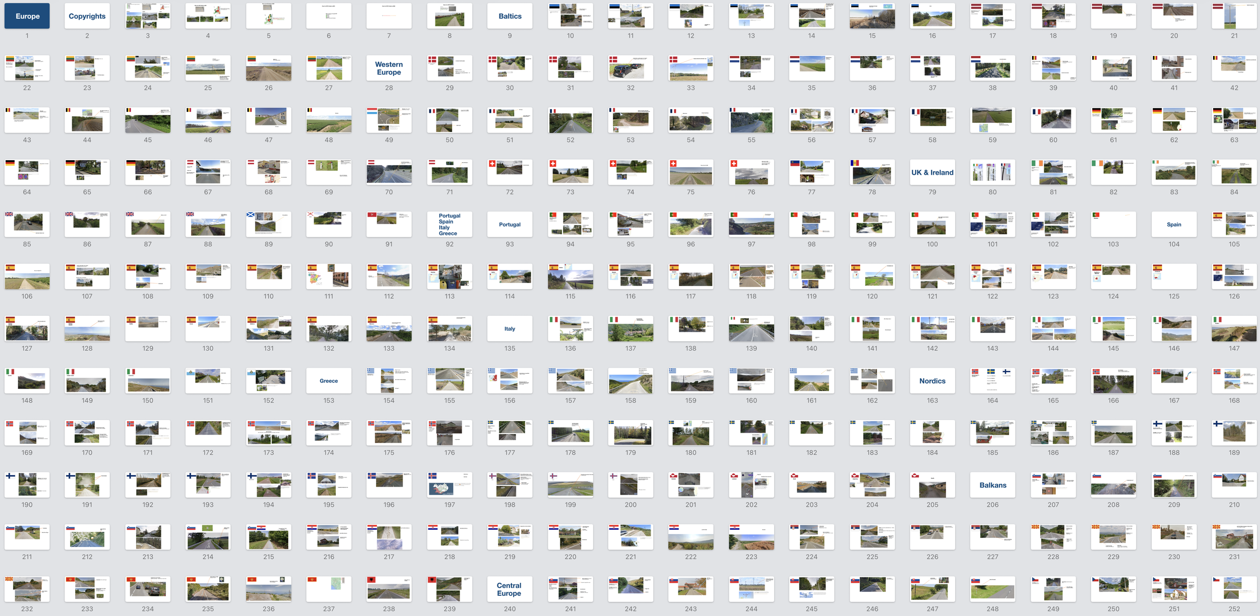
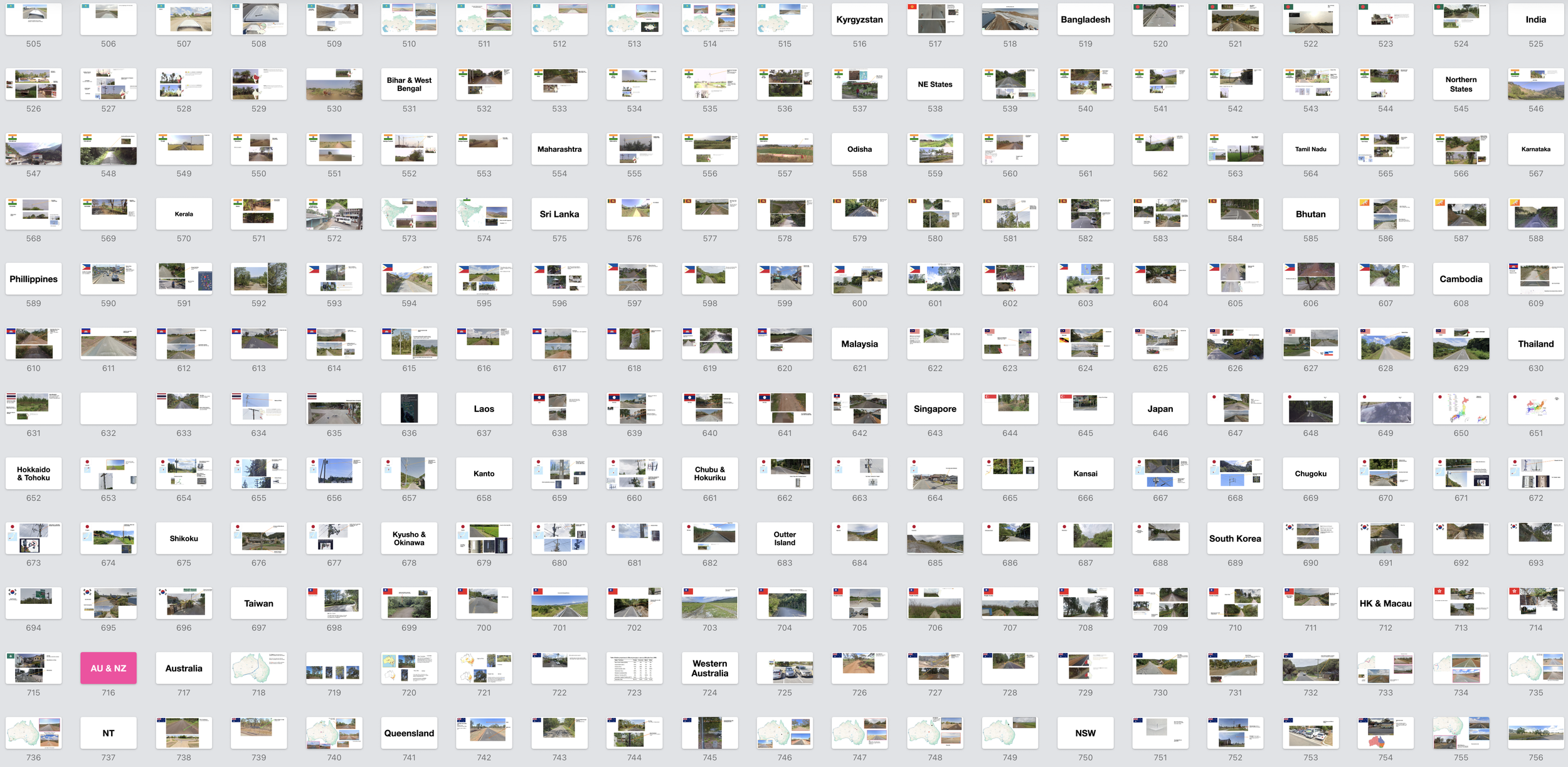
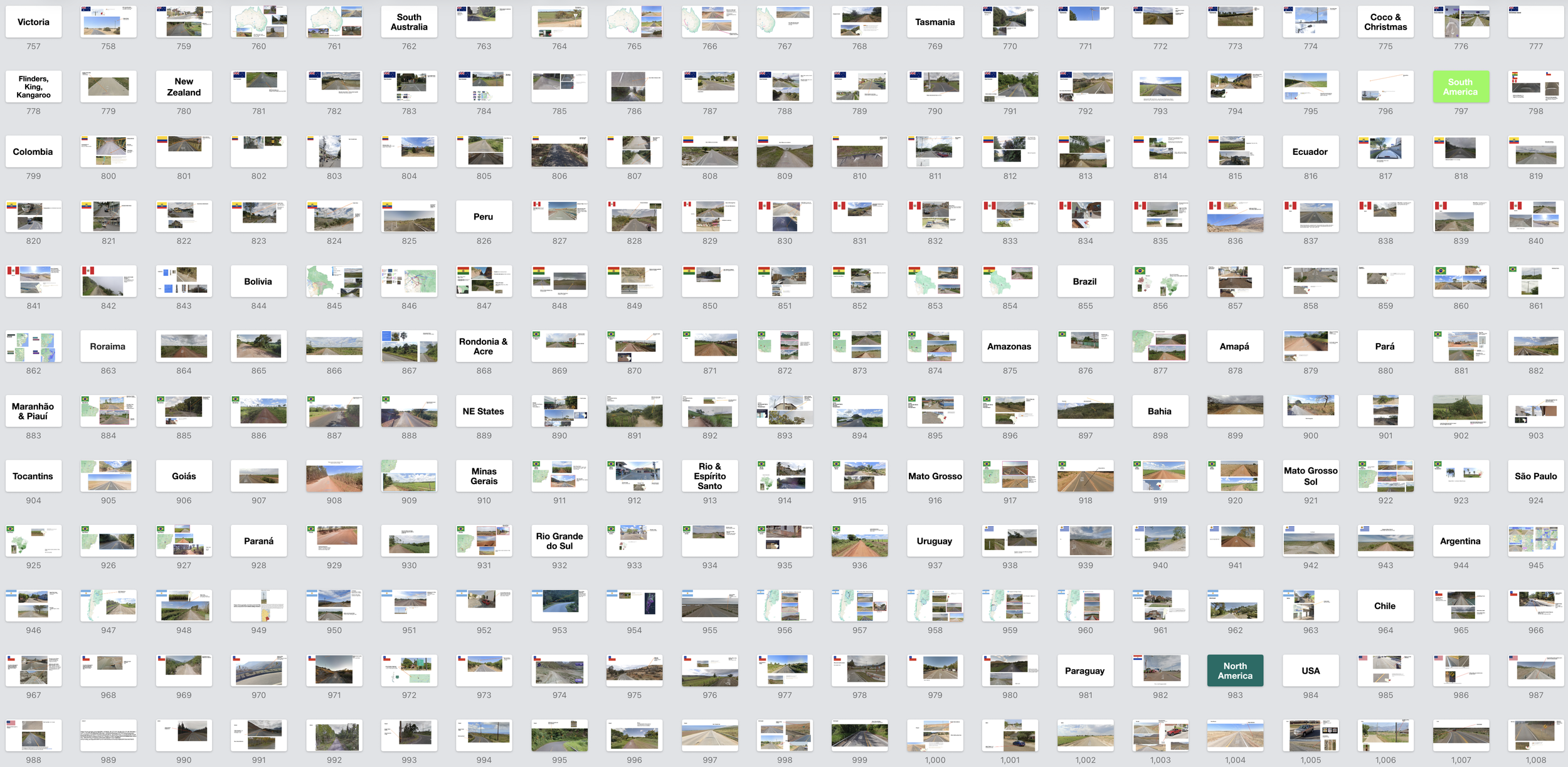
With roughly 90 countries in the game at the time, my Keynote eventually swelled to 1,325 slides. If you like geography and organizing useless information, it's a perfect way to fall down a rabbit hole.


Somewhere in there, I started loving the learning itself. I could tell Lithuanian utility poles from Latvian ones. A French bollard from a German one. A Paraná palm — native to Brazil's Santa Catarina — from a Belém palm, a thousand miles north.
That's about when my wife looked at me and asked, "So is GeoGuessr your personality now?"
Yes, it was.
When you have young kids, you need something — a hobby, a thing — that, unlike parenting, you can master. GeoGuessr gave me that: memorize European electrical poles, climb the pyramid, repeat.
That was the whole formula, and in my push to reach Champion I noticed something about how memory works.
You don't retain information through repeated exposure. You retain it by being tested on it right as you're about to forget it. My routine had become a naturally occurring version of spaced repetition, a term I only learned later.
I'd feel it mid-duel: staring at a bollard, certain I knew it, unable to summon the country. Belgium's bollards have a yellow square, just like Denmark's—but which one has the orange stripe at the top? There's a yellow plate on a car, which points to the UK, except the car is driving on the right, so maybe Luxembourg or the Netherlands.
Under pressure, with the clock ticking, the clues would blur together and I'd stab frantically at Czechia. But sometimes, just before I guessed wrong, the answer would surface from nowhere: Belgium doesn't have the orange stripe. The yellow plate must be because this is near the Luxembourg border. And once I'd pulled a fact out of the void like that, it would be locked in.
The knowledge that vanished under pressure started sticking. On December 9th, 2024 — six months after I subscribed — I finished at the top of Master I and was promoted to Champion.
I told my wife
The steady climb: Jan '25 - Dec '25
Below Champion, you're ranked inside a 20-player league. In Champion you get a single ELO number, like in chess, and you're ranked against the entire world by that number alone.
I'd told myself that once I was comfortably in Champion, I'd be satisfied and everything after that would be for fun. This turned out to be naive. If Champion got me in the door, ELO kept me up at night.
Something else changes once you reach Champion: the map. Every league uses an API to pull real Google Street View locations. But the maps in lower leagues lean urban, where there are more street signs, storefronts, and other easy tells. Champion leans rural. Often it's just a road and whatever's growing beside it.
My Keynote was great for memorizing bollards and road lines, but rural rounds aren't typically won by spotting infrastructure. They're won by learning coverages.
A coverage is a visual fingerprint you can identify not just by a landscape but also by the Google Street that covered it and the time of the coverage.
Take the area around Mirny, Russia. It's instantly recognizable for its dense pine trees and dirt road but also by the fact that it was covered with Google's newest camera and during wildfire season. See it once, you'll never mistake it again.