How I became a GeoGuessr champion while raising three kids under six
A data-driven story about beating unmarried, childless Gen Z geography nerds at their own game.
In the summer of 2024, I had a bad habit. Every morning when I got to my office, I'd watch YouTube while I ate breakfast. When I finished eating, I'd watch for another 20 minutes. Then I'd start work. That's about 45 minutes every morning lost to the Internet.
During one of these binges, I came across a WIRED video of GeoGuessr player Trevor Rainbolt explaining his guesses. If you're not familiar: GeoGuessr drops you into a random Google Street View image somewhere in the world and asks you to guess where you are.
I've always loved geography, so I paid the $1.99 subscription fee and swapped YouTube for GeoGuessr.
Two years later, I had risen to become the 354th ranked player in the world – out of roughly 100,000 – and in the United States.
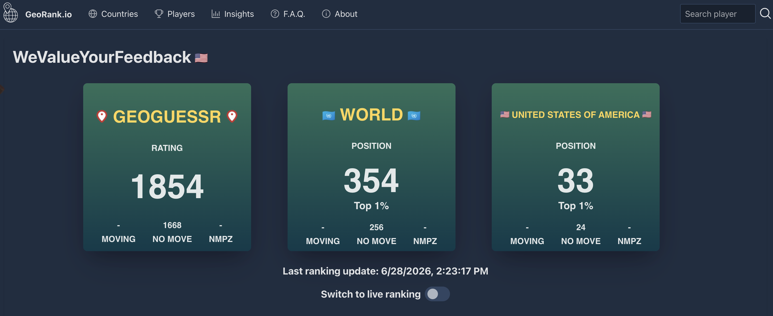
That in itself isn't that impressive. The tier above me — the uber nerds headed to the GeoGuessr World Cup in September — could easily beat me. What's impressive is that I got there while running my own consultancy and raising two young kids, with a third arriving right at the end of my run.
This is a story about how I used forty-five minutes before work to beat people who had all day to practice.
It's also a story about what happened the night I finally hit my highest ranking — and why, a few days later, I quit trying entirely.
Six months to Champion
You can get pretty good at GeoGuessr without ever competing. You just play for fun. Competitive GeoGuessr is something else entirely. In a duel, two players face the same location at the same time and both guess where it is. Closer wins the round. Do that over several rounds and someone gets knocked out.
Everyone exists within a division and – like a soccer pyramid – gets promoted or relegated based on their standing at the end of the week. I entered at the bottom, Bronze I (there were only when I started), thinking that I'd earn a promotion or two at best.
| Division | Promotion | Relegation |
|---|---|---|
| Champion | – | 13% |
| Master I | 10% | 13% |
| Master II | 13% | 13% |
| Gold I | 13% | 16% |
| Gold II | 16% | 13% |
| Gold III | 20% | 10% |
| Silver I | 36% | 13% |
| Silver II | 50% | 13% |
| Silver III | 50% | – |
| Bronze | 70% | – |
But I climbed the pyramid fast, promoted five weeks straight. I had a good system. I'd in the morning and play a few duels between 4:30 to 5pm, right before I picked up my kids. I never played on weekends. With kids, that wasn't an option.
After every duel, I'd examine my guesses and check Plonkit.net — a community-built site with country-specific guides — to see if I'd missed a clue.
Here's one miss. I guessed Czechia but the correct answer was Denmark. Scroll through and see four clues that gave it away.
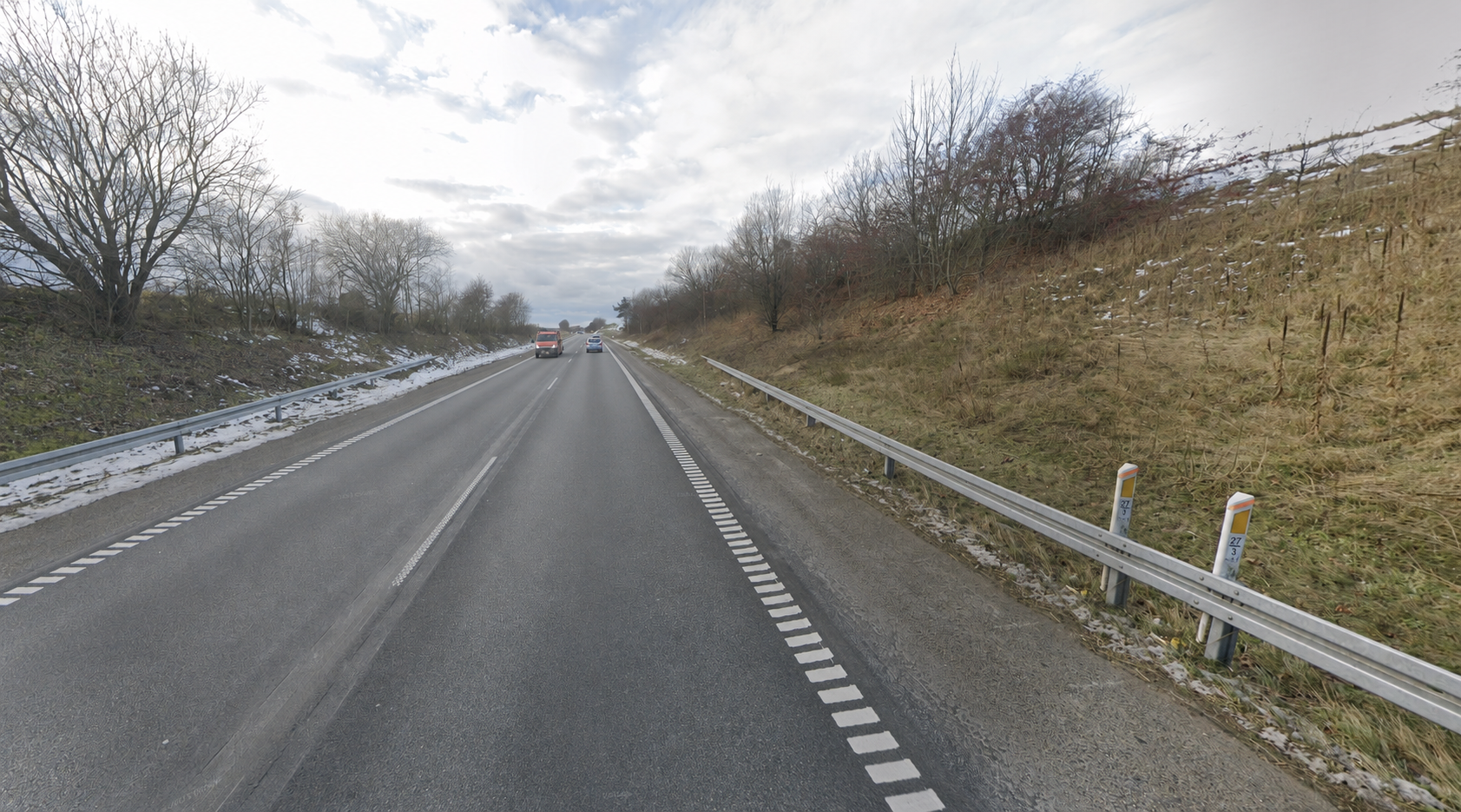
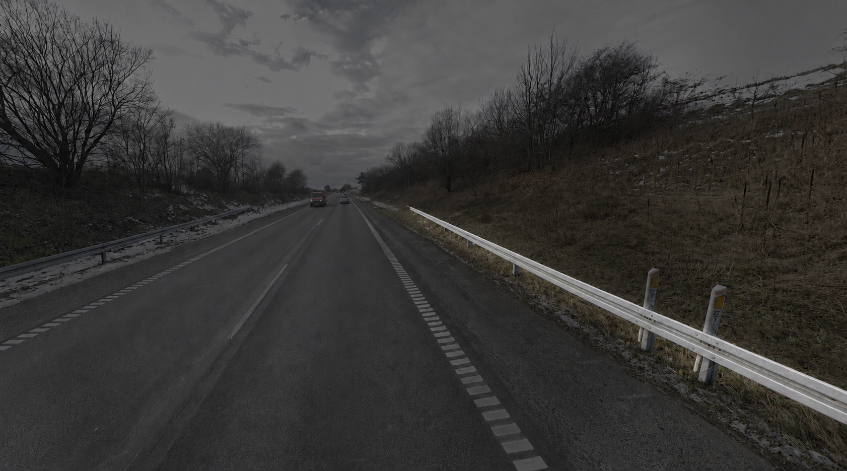
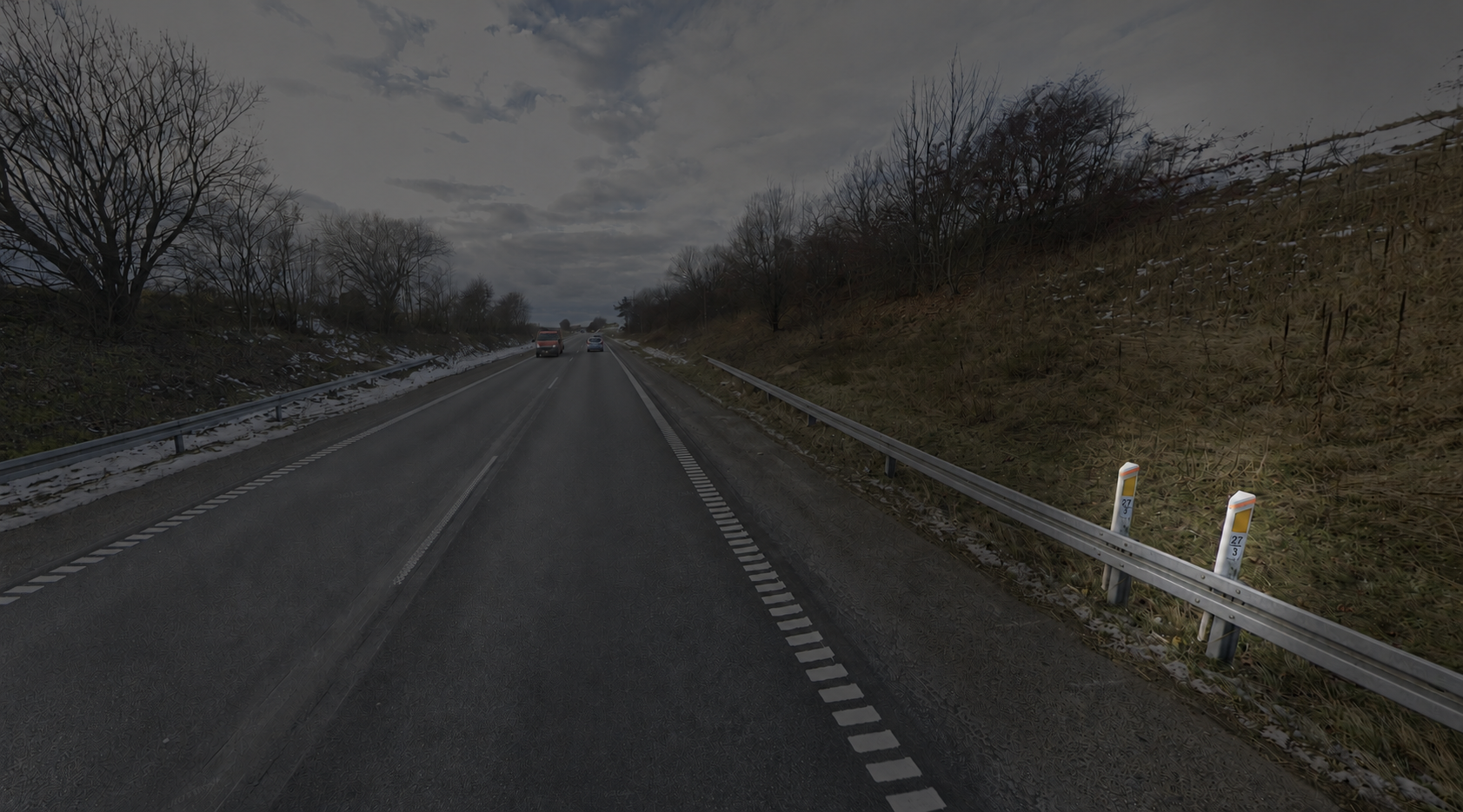
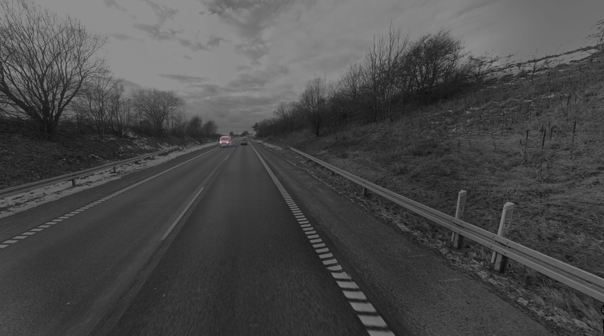
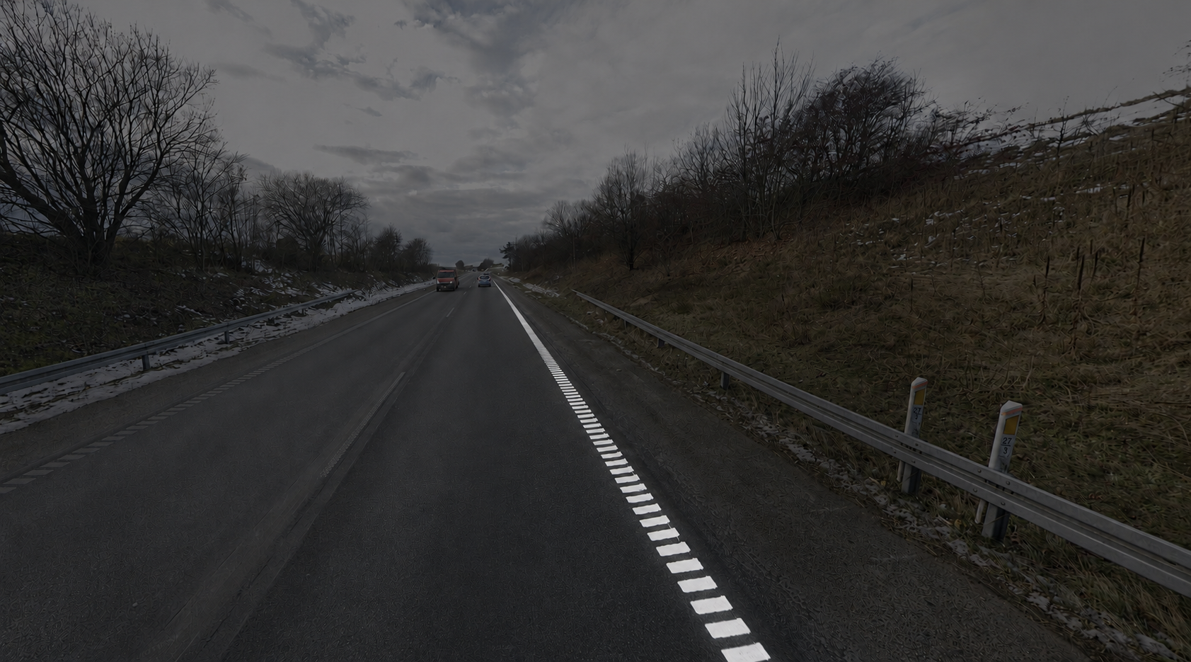
B-type guardrails. Denmark is one of just eight European countries using this design — the GeoGuessr community nicknamed it "B-type."
The bollard. White post, yellow reflector, orange stripe. This exact combination exists nowhere else on Earth.
Dashed outer white lines. It varies by region, but outer road lines in Denmark often consist of small white squares.
Yellow plates on trucks. Like most European countries, standard plates in Denmark are long and white, with a blue strip on the left. However, plates on commercial vehicles are yellow.
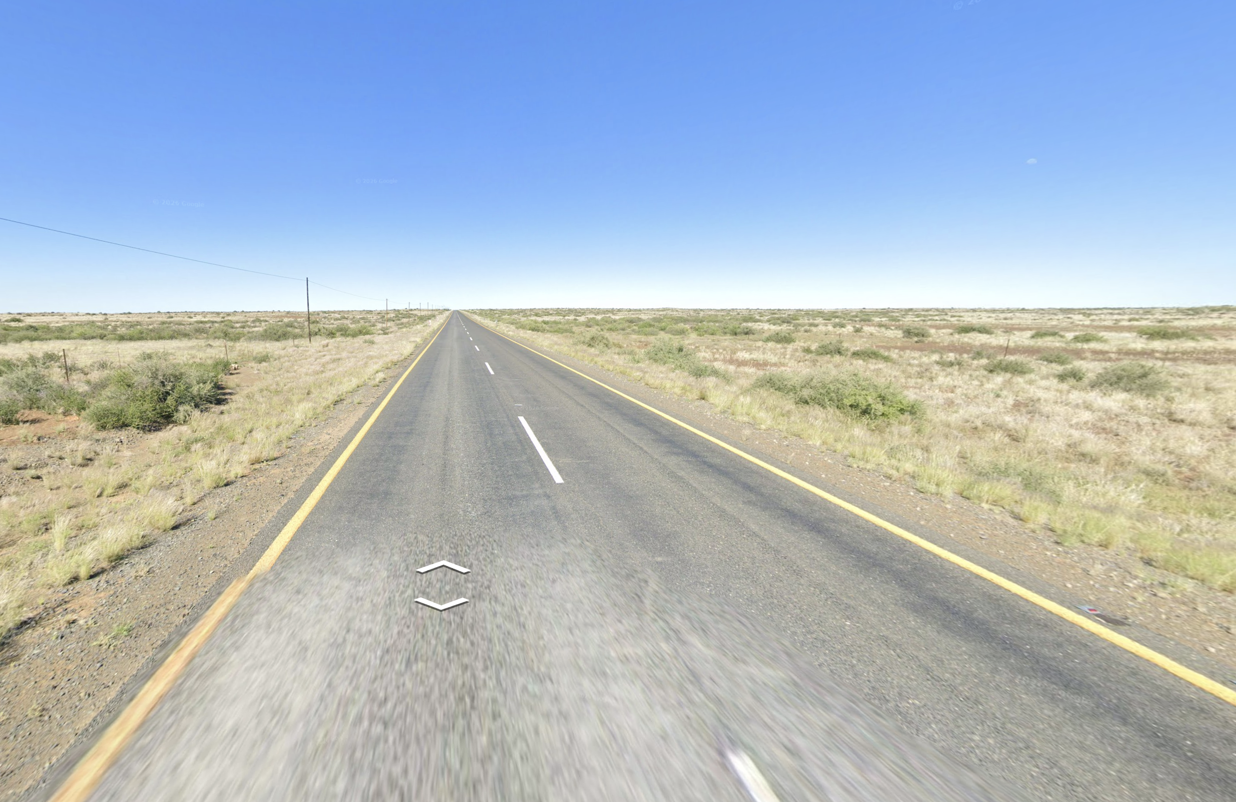
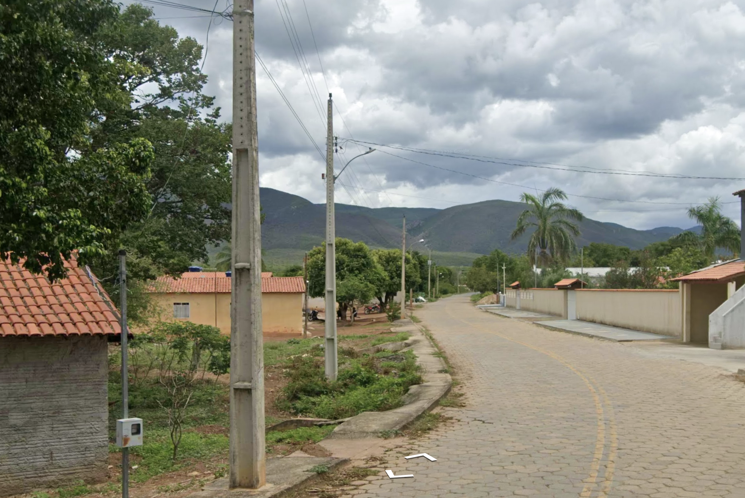
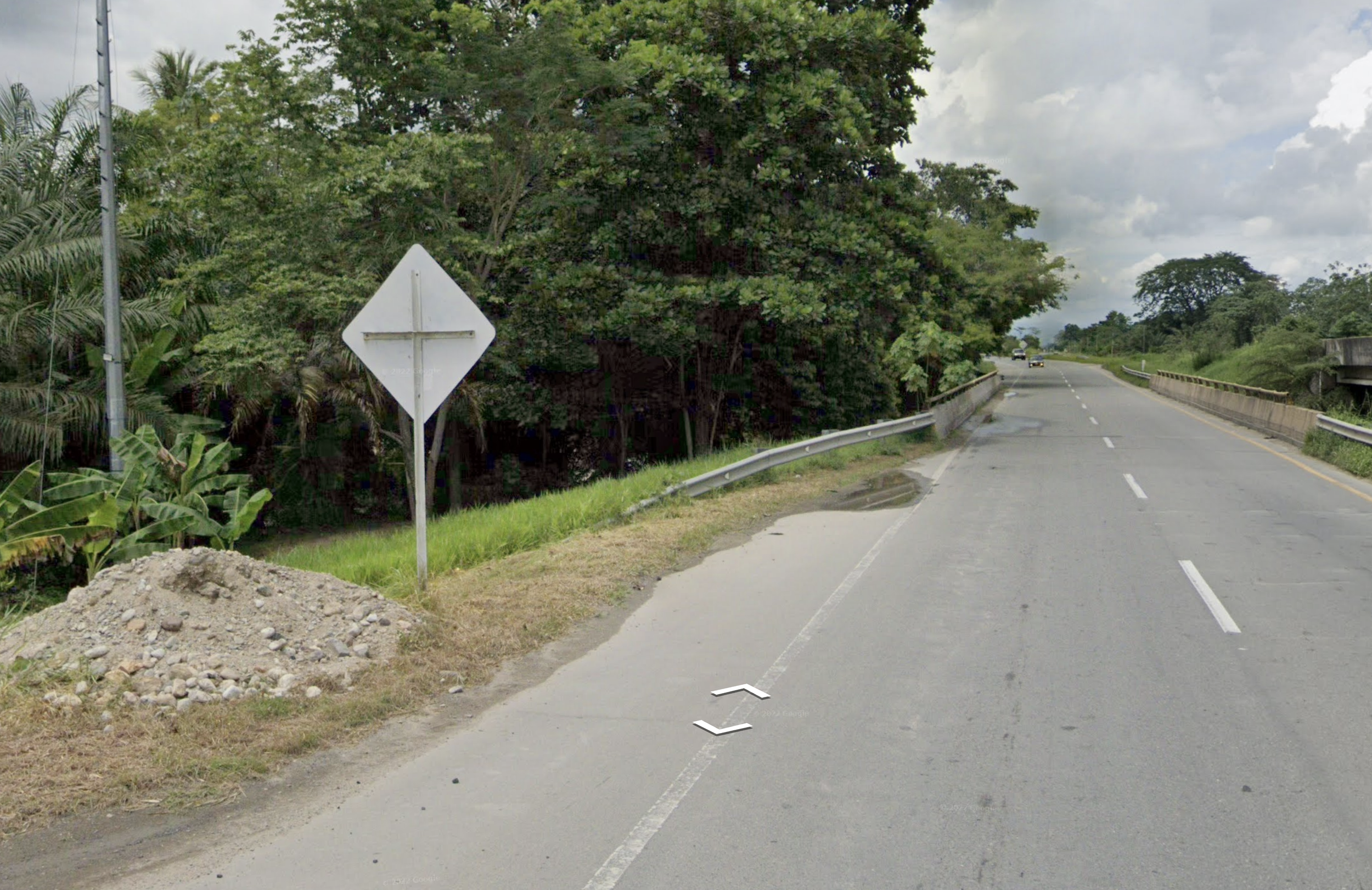
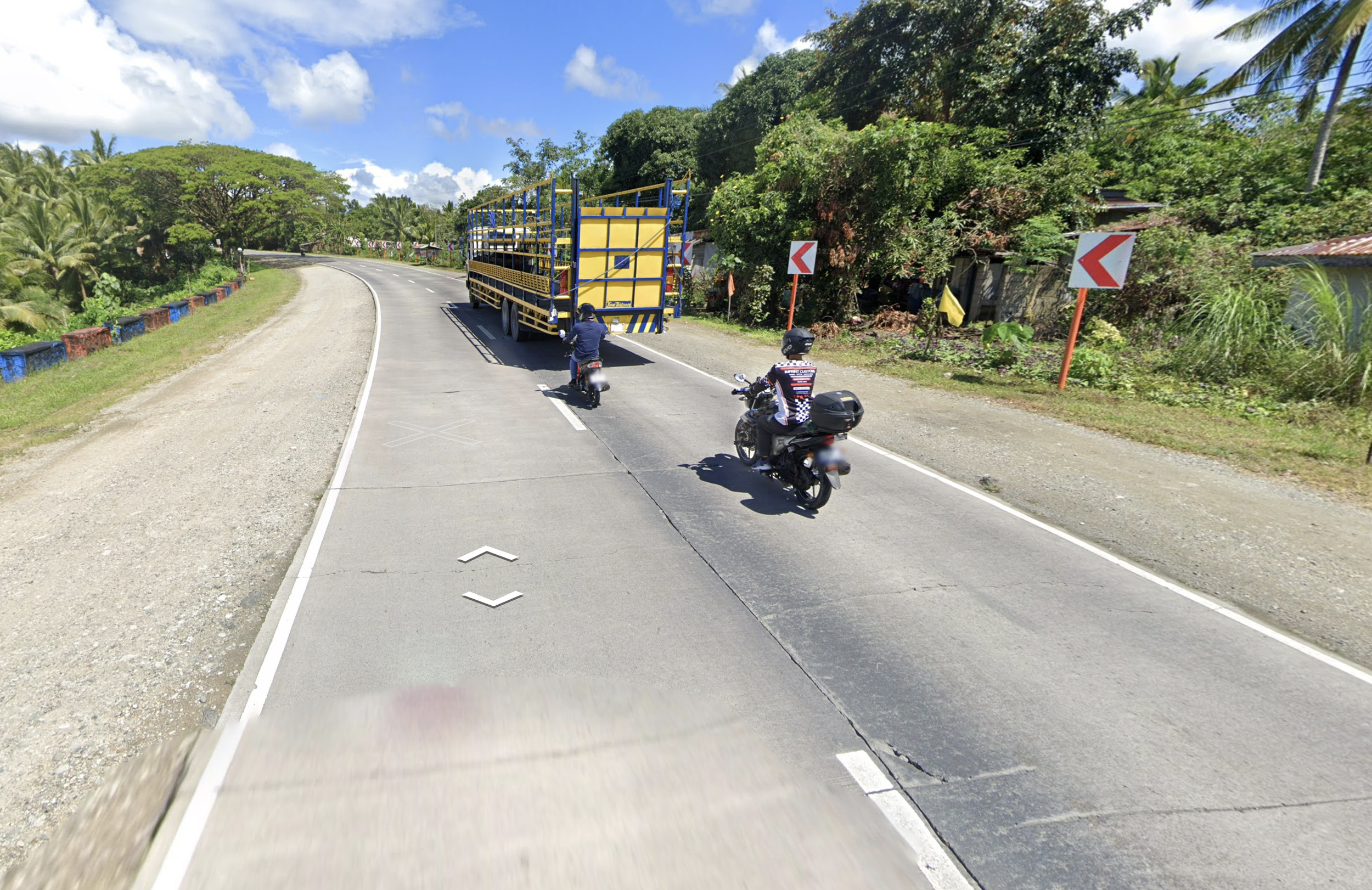
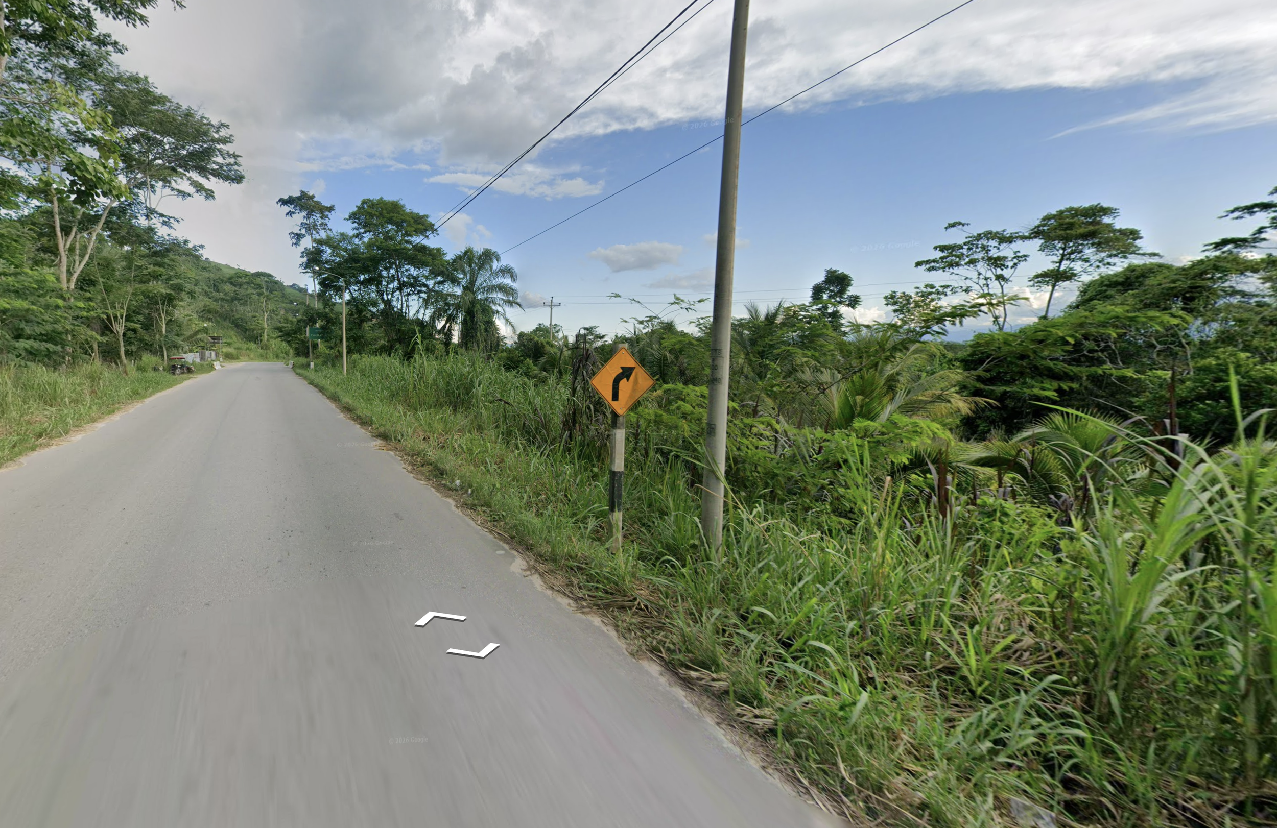
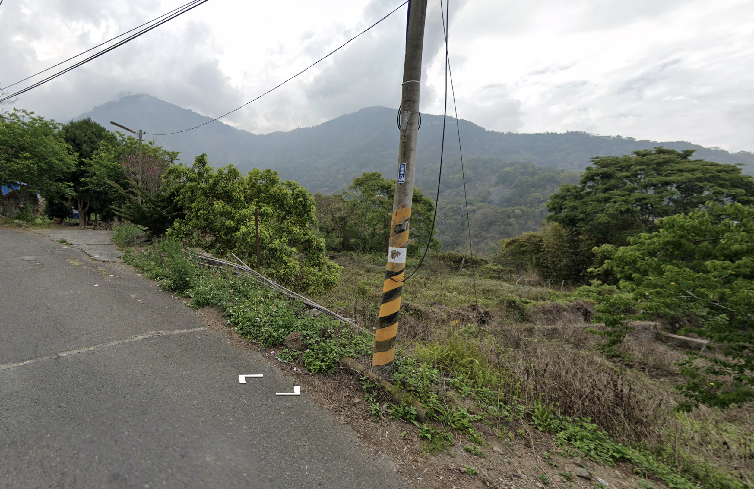
Every country has clues that I’d screenshot and drop into a Keynote I created.
- Outer yellow lines in South Africa
- Ladder poles in Brazil
- The Colombian cross
- Concrete roads in Philippines
- Black & white sign posts in Peru
- Taiwanese pole reflectors
After a few weeks of seeing clues in practice rounds and duels, they started to stick.
With roughly 90 countries in the game at the time, my Keynote eventually swelled to 1,325 slides. If you like geography and organizing useless information, it's a perfect way to fall down a rabbit hole.
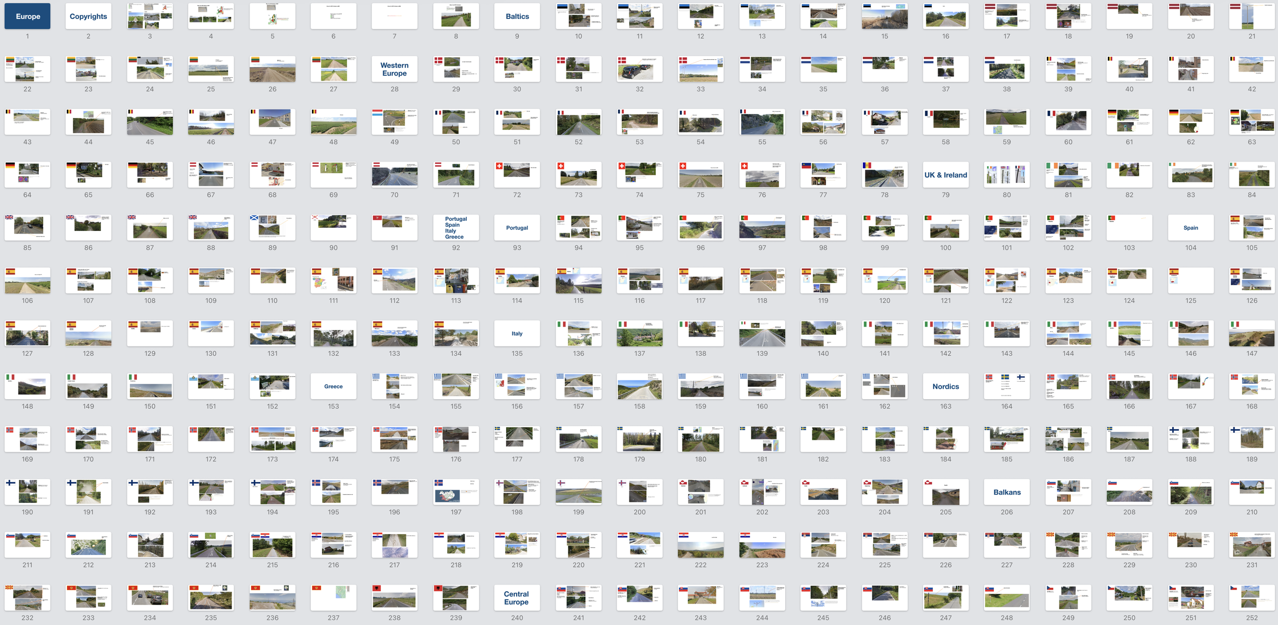

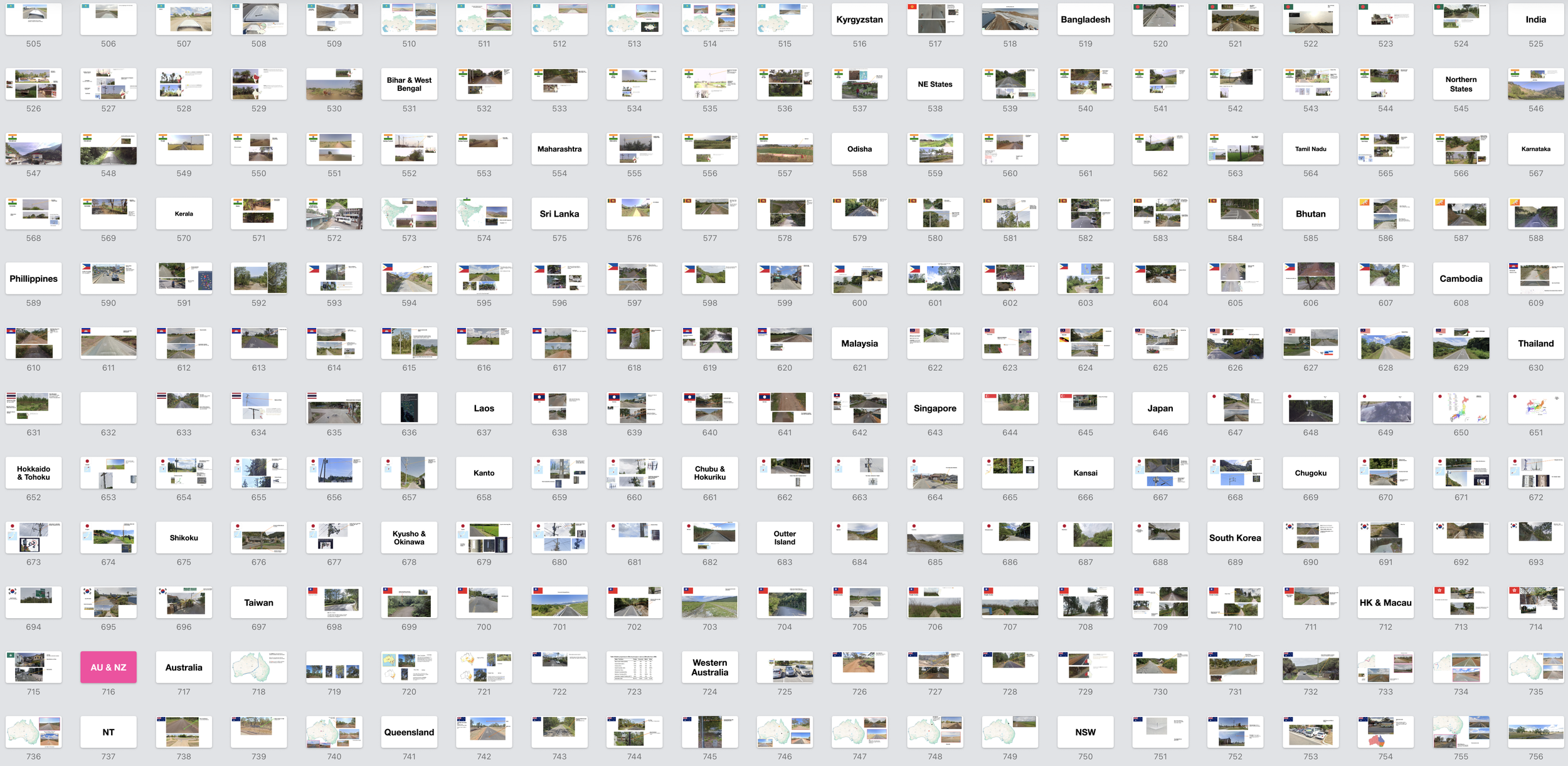
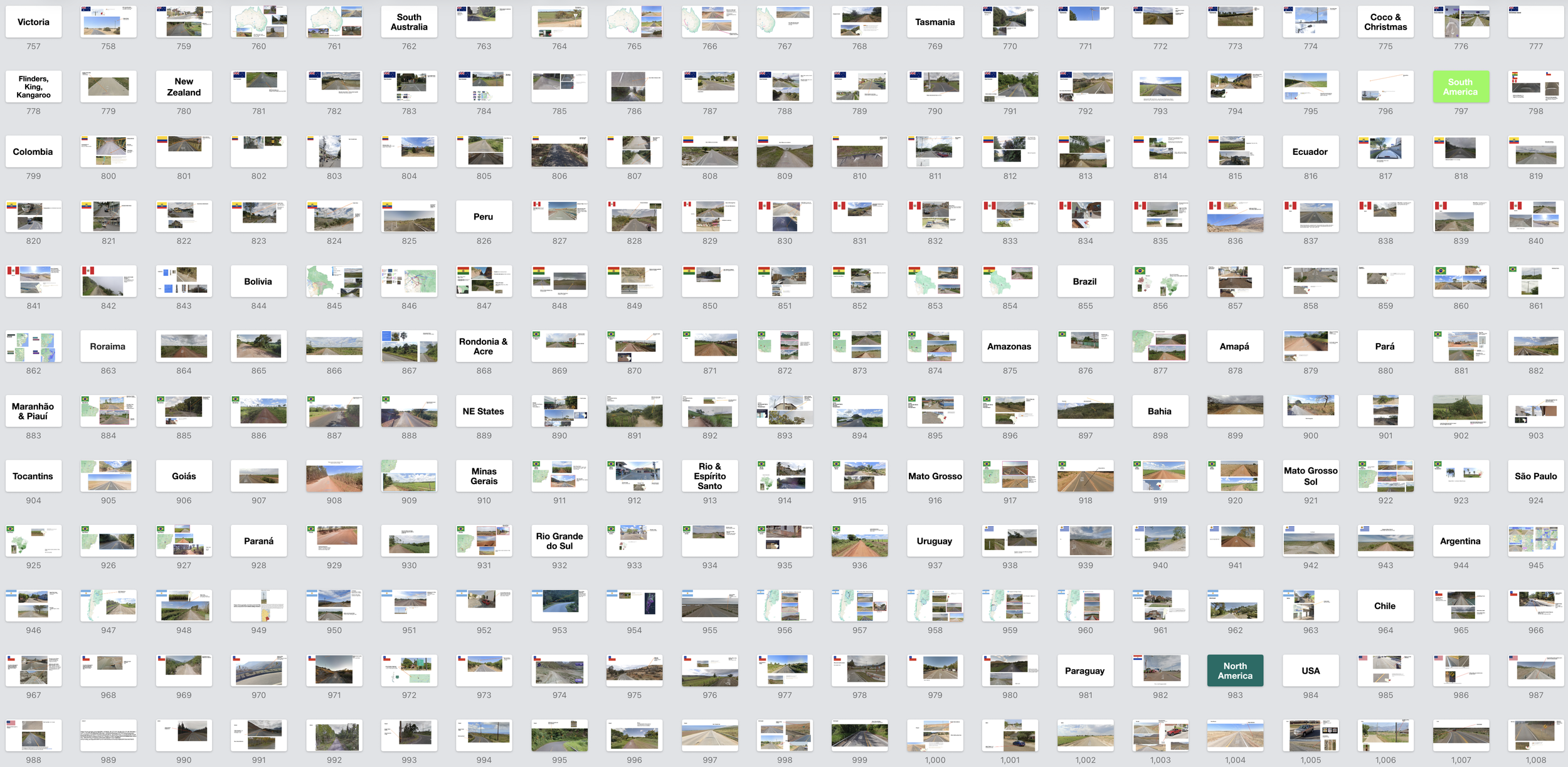
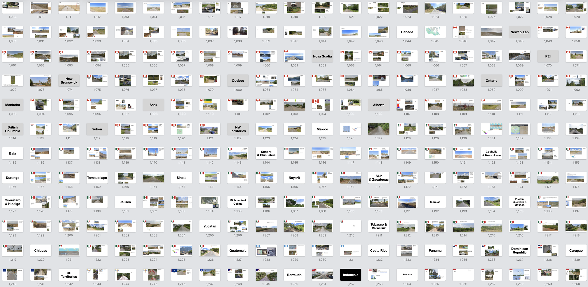

If you think my Keynote is insane, it's nothing. A player named mdsylvester wrote a just on Mongolia. Another wrote a about trees in Brazil.
I wasn’t that dedicated, but I started loving the learning itself. I could tell Lithuanian utility poles from Latvian ones. A French bollard from a German one. A Paraná palm — native to Brazil's Santa Catarina — from a Belém palm, a thousand miles north.
That's about when my wife looked at me and asked, "So is GeoGuessr your personality now?"
Yes, it was.
When you have young kids, you need something — a hobby, a thing — that unlike parenting, you can master. GeoGuessr gave me that: memorize European electrical poles, climb the pyramid, repeat.
That was the whole formula, and in my push to reach Champion I noticed something about how memory works.
You don't retain information through repeated exposure. You retain it by being tested on it right as you're about to forget it. My routine had become a naturally occurring version of spaced repetition, a term I only learned later.
I'd feel it mid-duel: staring at a bollard, certain I knew it, unable to summon the country. Belgium's bollards have a yellow square, just like Denmark's—but which one has the orange stripe at the top? There's a yellow plate on a car, which points to the UK, except the car is driving on the right, so maybe Luxembourg or the Netherlands.
Under pressure, with the clock ticking, the clues would blur together and I'd stab frantically at Czechia. But sometimes, just before I guessed wrong, the answer would surface from nowhere: Belgium doesn't have the orange stripe. The yellow plate must be because this is near the Luxembourg border. And once I'd pulled a fact out of the void like that, it would be locked in.
The knowledge that slipped away under pressure started to hold. On December 9th, 2024 — six months after I subscribed — I finished at the top of Master I and was promoted to Champion.
I told my wife.
Learning landscapes
Below Champion, you're ranked inside a 30 or 60-player league. In Champion you get a single ELO number, like in chess, and you're ranked against the entire world by that number alone.
I'd told myself that once I was comfortably in Champion, I'd be satisfied and everything after that would be for fun. This turned out to be naive. If Champion got me in the door, ELO kept me up at night.
Something else changes once you reach Champion: the map. Every league uses an API to pull real Google Street View locations. But the maps in lower leagues lean urban, where there are more street signs, storefronts, and other easy tells. Champion leans rural. Often it's just a road and whatever's growing beside it. My Keynote was great for memorizing bollards and road lines, but rural rounds aren't typically won by spotting infrastructure. They're won by learning coverages.
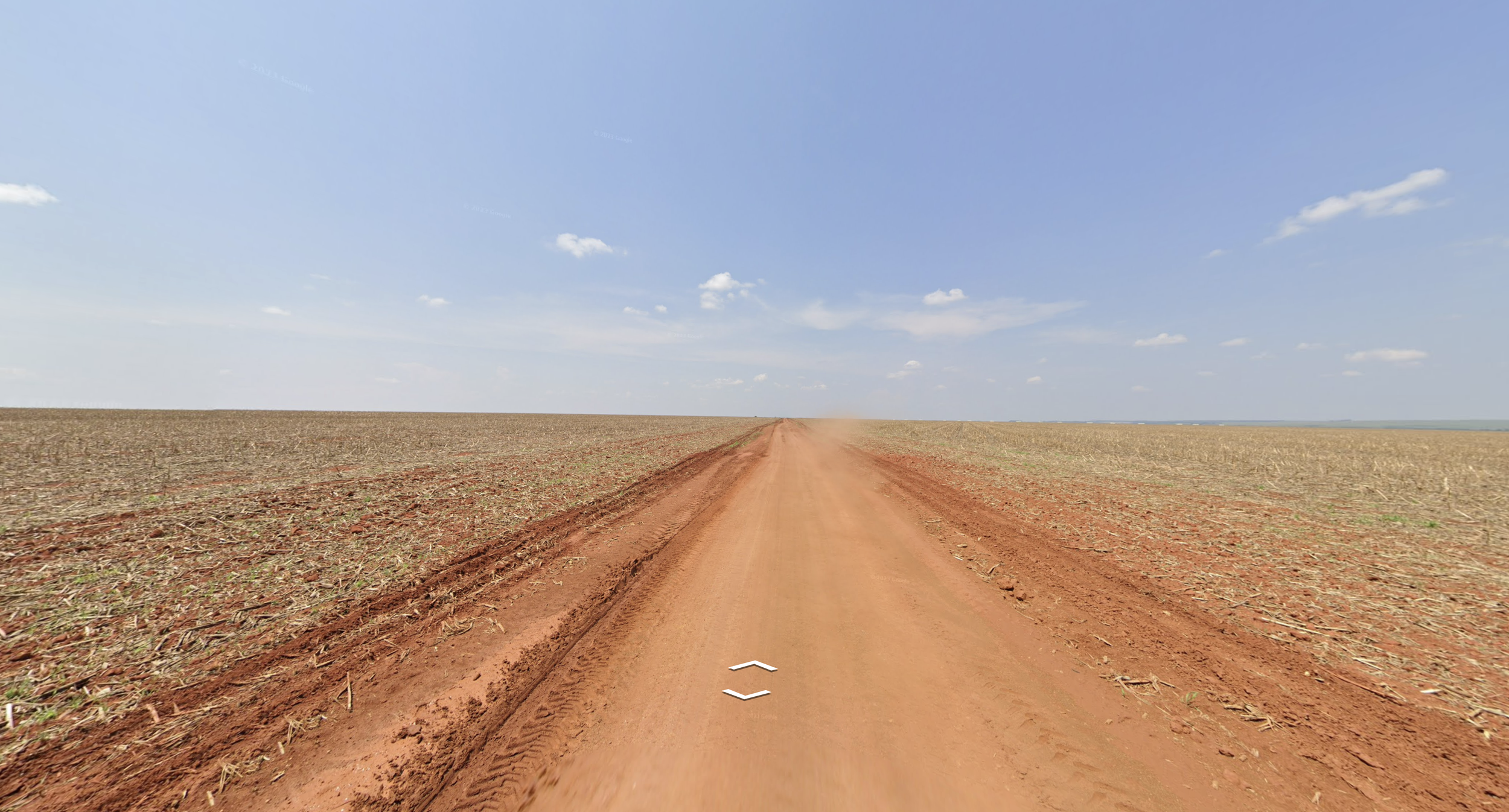
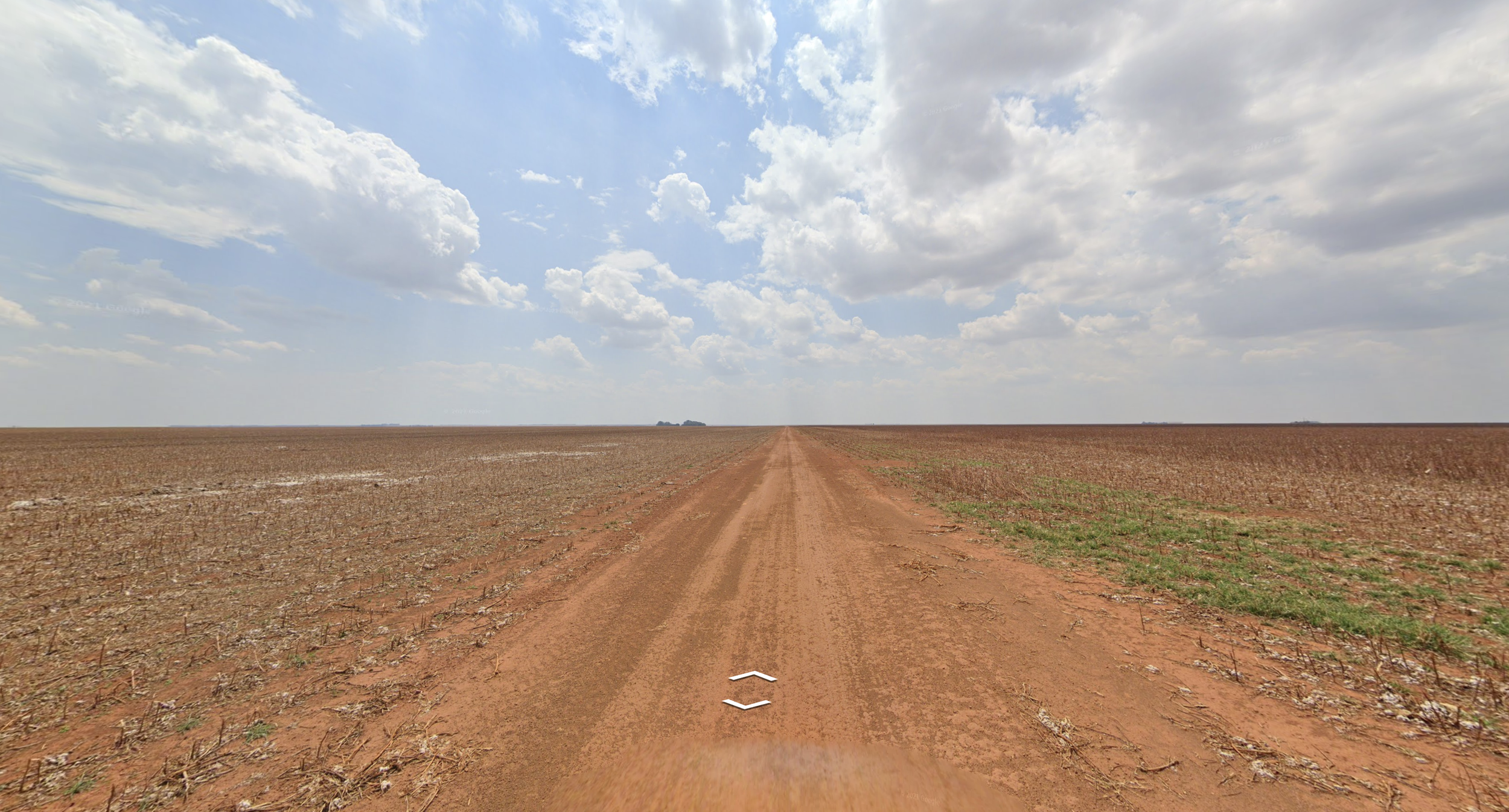
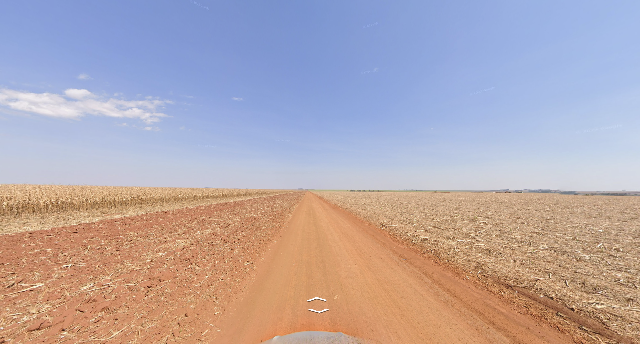
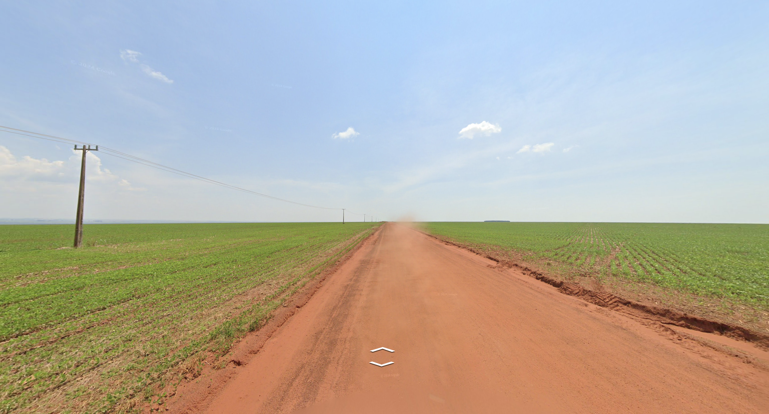
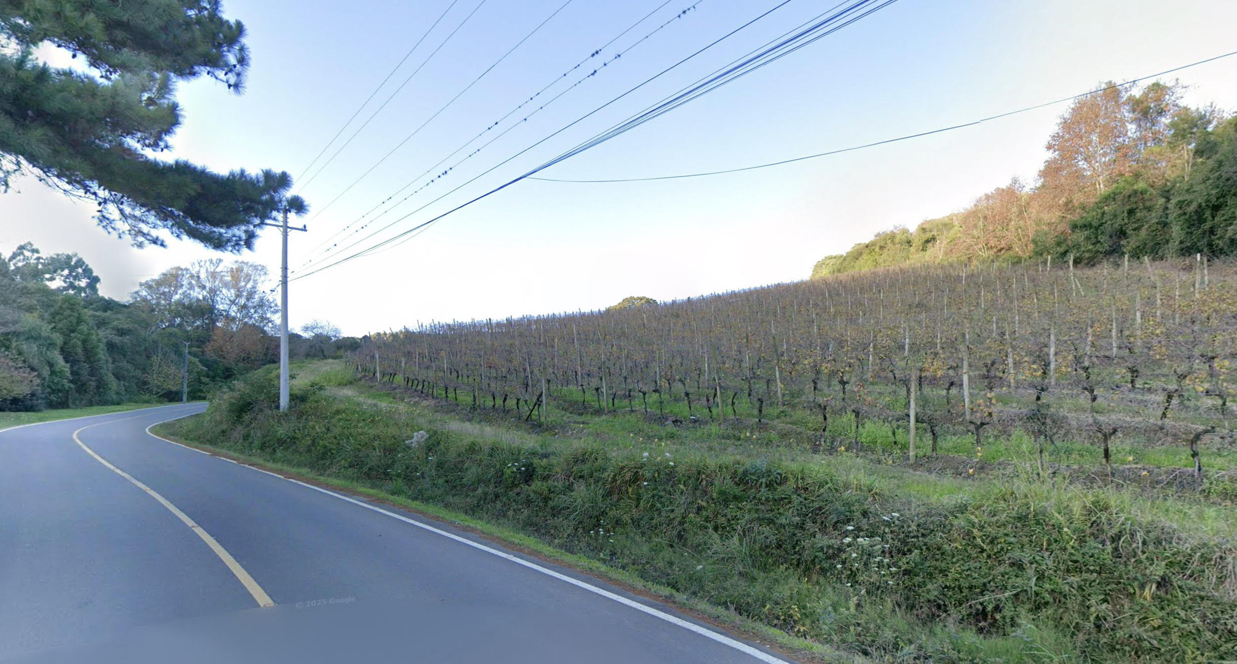
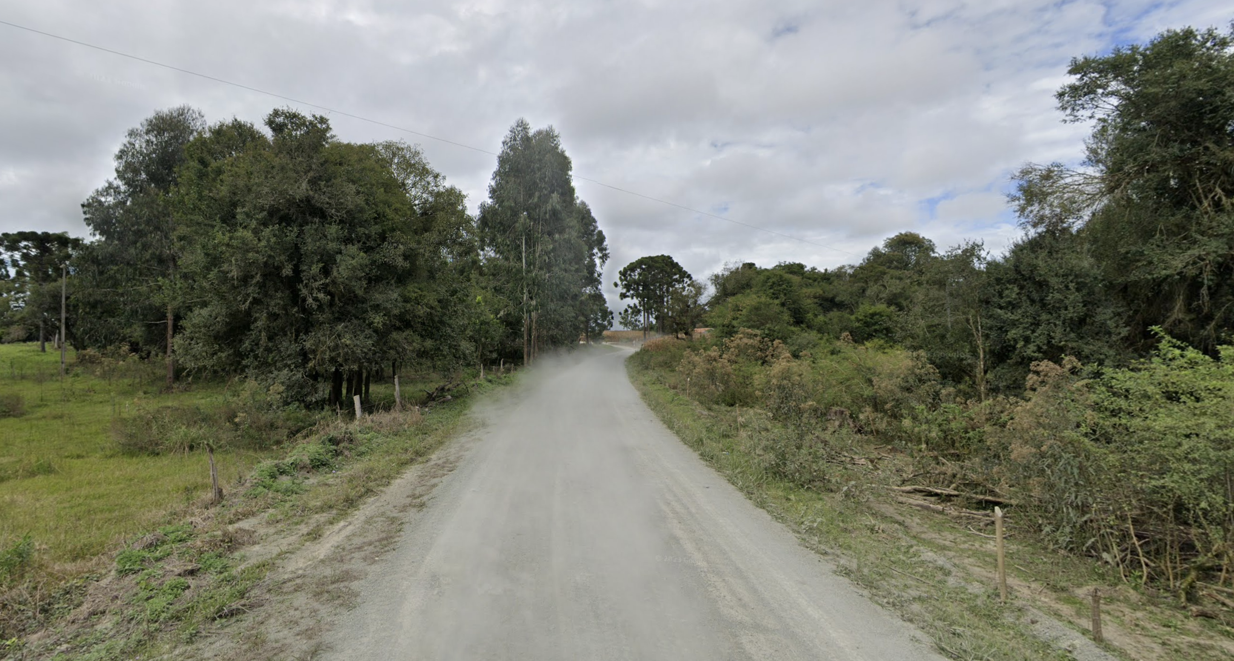
A coverage is a visual fingerprint you can identify not just by a landscape but also by the Google Street View car that covered it and the time of the coverage. Take the area around Mirny, Russia. It's instantly recognizable for its dense pine trees, dirt road, and the fact that it was covered with Google's newest camera and during wildfire season. , you'll never mistake it again.
I quickly realized that the key to learning coverages is stacking clues: this soil, plus this crop, plus this time of year, equals here.
Here’s an example.
Loading Street View…
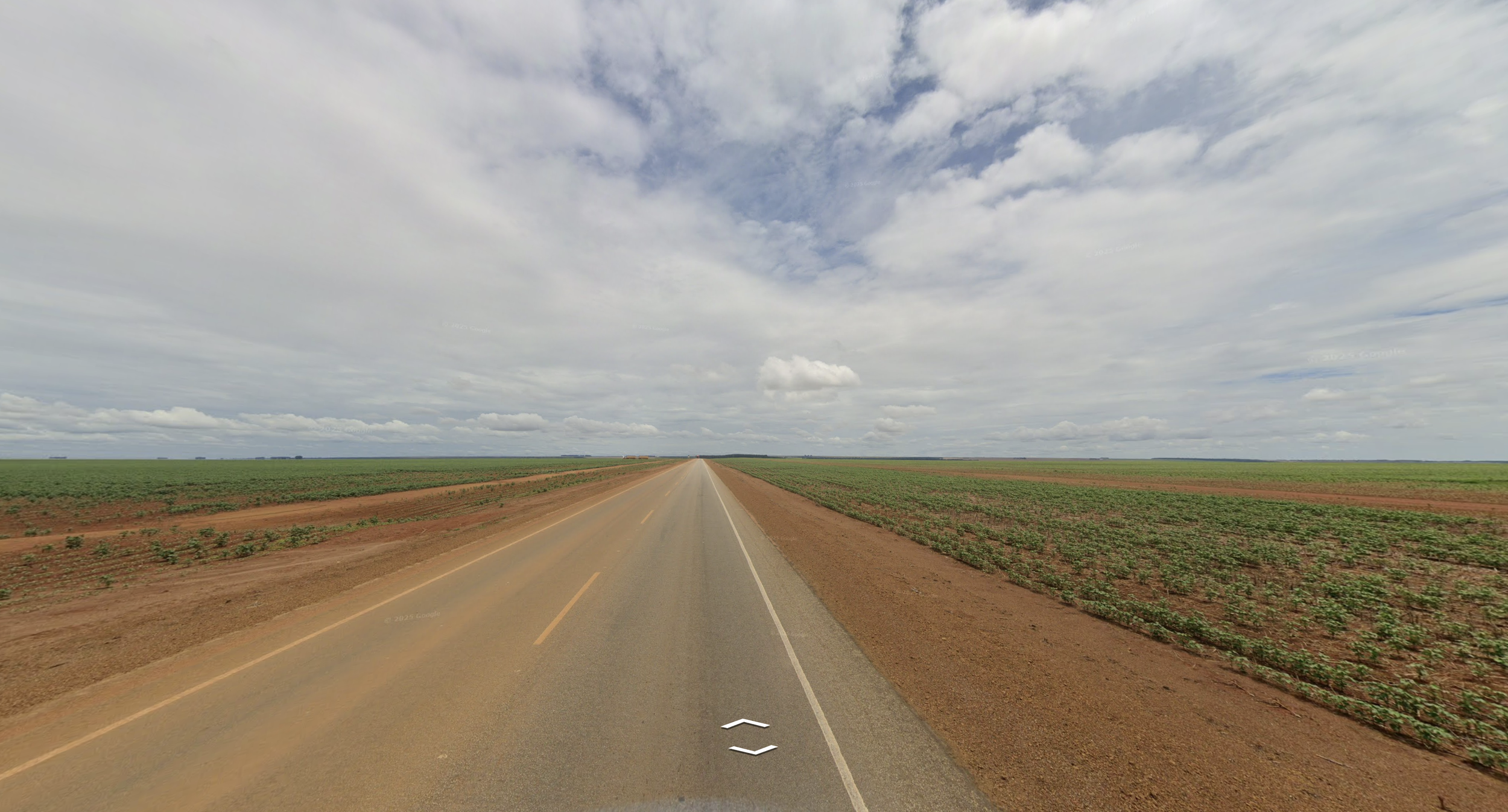
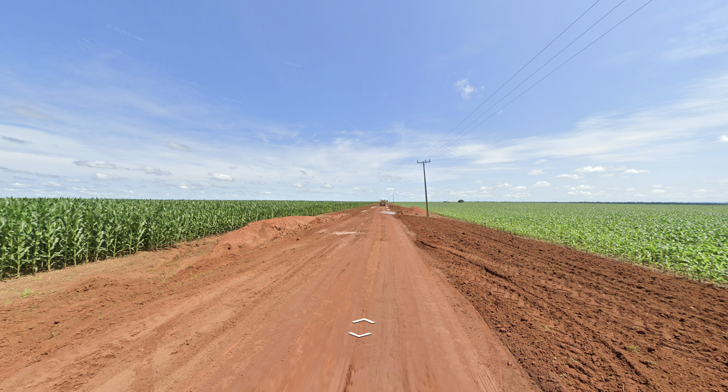
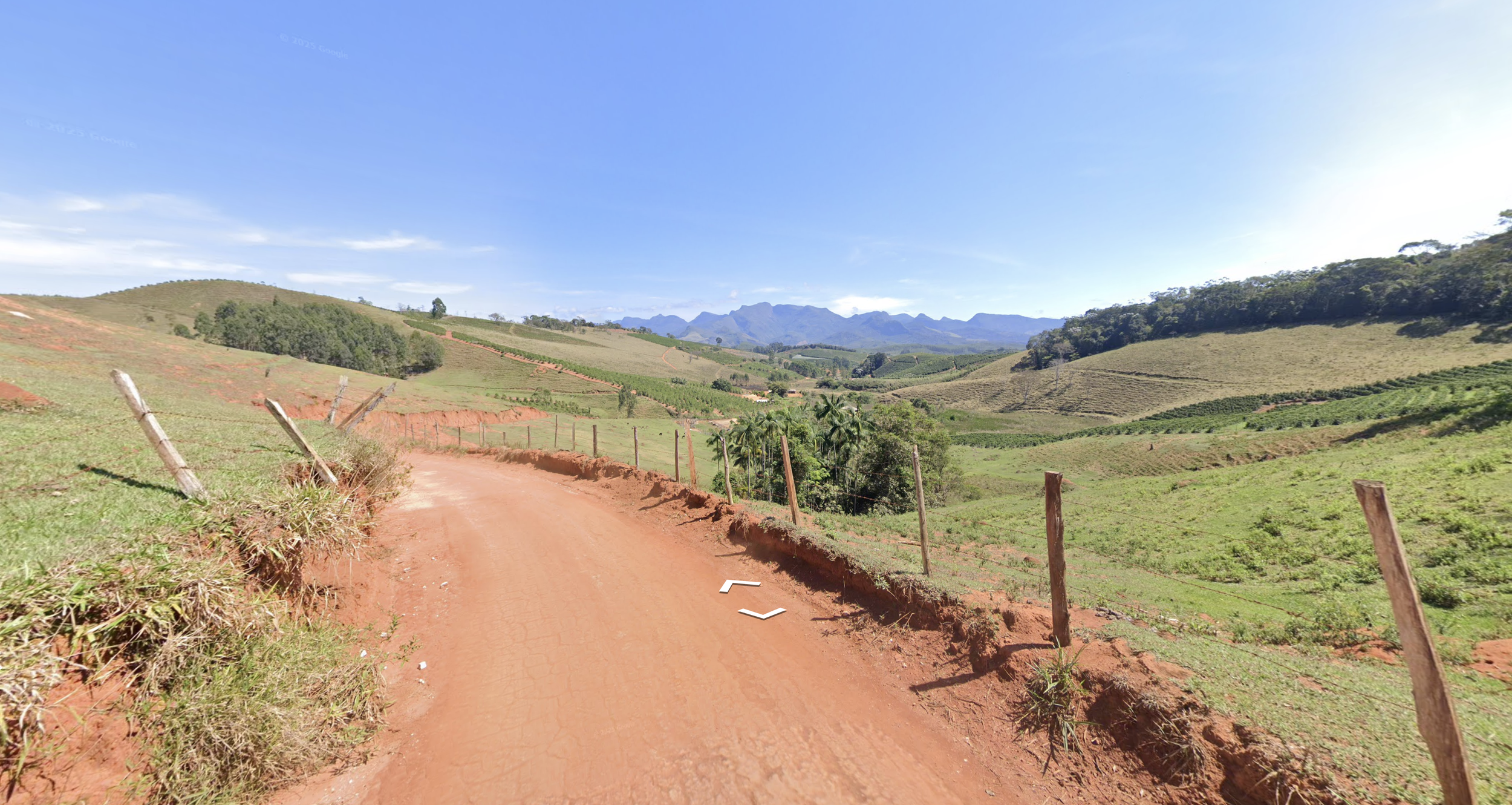
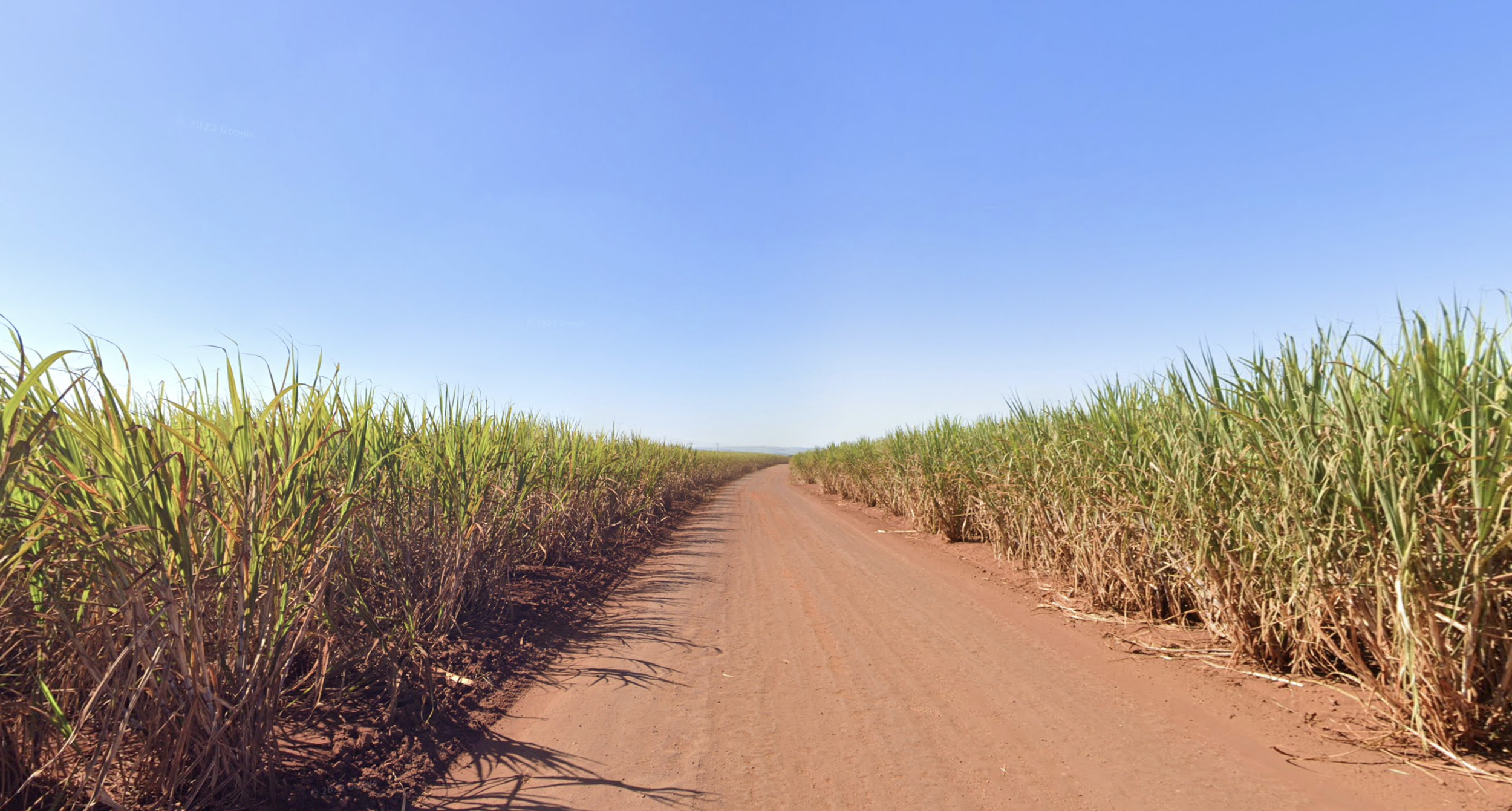
In total, I tagged 7,244 locations in Brazil with notable landscapes or features.
- Horizon, VNT
- Coffee plantations
- Sugar cane plantations
- Wind farms
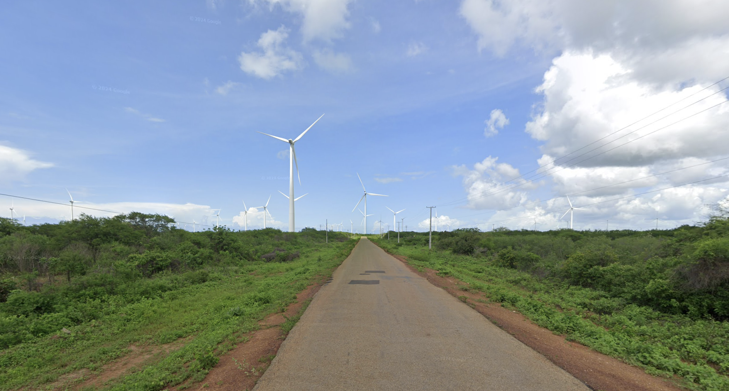
- Vineyards
- Gray, rocky gravel roads
0tagged locations
Many parts of Africa and Asia don’t appear in GeoGuessr because they aren’t covered by Google Street View.Large parts of Africa and Asia lack Google Street View coverage.
In total, I tagged 7,244 locations in Brazil with notable landscapes or features.
Globally, I tagged 66,838 total locations.
In the Champion division, getting good — moving your ELO — came down to internalizing coverages. This ended up being my favorite part of the game, because instead of memorizing electrical poles and chevrons and road markings, I was learning about the world.
Years ago I'd read about orangutan populations collapsing in Indonesia. Now I could picture exactly why — mile after mile of oil palm plantations, planted in perfect rows, swallowing rainforests in Sumatra and .
I grew up in the Midwest, where the Great Plains always felt like the most boring backdrop imaginable. But nowhere else on Earth will you find a thousand miles of flat, lined with a near-perfectly symmetrical north-south road grid.
Coverages are harder to learn than electrical poles. India's summer monsoon changes the landscape in the north so completely that a rice field in looks nothing like the same field in . Learning India meant learning the difference between kharif and rabi crops. And even when you've accounted for the season, you're often left with nothing more than a vibe.
In a duel, this could be a real problem. Half of you is convinced you're looking at a sugar cane plantation in São Paulo. The other half is wondering if it’s Lampung, Indonesia. It’s a narrow dirt road, so you don’t know if you’re driving right, which would rule out Indonesia. Both are close enough to the equator that the sun's position doesn't help either. All you want is a Brazilian ladder pole next to the road — something, anything, that turns a feeling into a fact.
The challenge wasn't just finding time. It was knowing where to spend it. I could practice Indonesia, a country notorious in GeoGuessr for its huge point swings, and get better at region-guessing there. That would also sharpen my sense of its neighbors—Malaysia, Thailand, Vietnam, the Philippines. But every hour I spent on Indonesia was an hour I didn't spend learning coverages elsewhere.
Ideally, I'd have had a list of every coverage, ranked by ROI per practice hour, so I always knew where to put my next session. But no such list existed. Worse, I didn't even know where I was weak. Was I bad in Indonesia, or did it just feel that way because I'd botched a couple of guesses there recently?
Solving this ROI problem wasn't just important. It was essential. The higher I climbed, the more my opponents skewed young, male, and unattached. They could afford to be encyclopedic. I couldn't.
What 12,710 guesses revealed
Then, in the PlonkIt Discord, I found a tool built by a user named InzyBhai that I used to pull my duel stats from geoguessr.com. The file that came back was underwhelming to look at — just rows and timestamps – but when I analyzed the data I discovered that I had been thinking about my bad guesses incorrectly.
Then, in the PlonkIt Discord, I found a tool built by a user named InzyBhai that I used to pull my duel stats from geoguessr.com. The file that came back was underwhelming to look at — just rows and timestamps – but when I analyzed the data I discovered that I had been thinking about my bad guesses incorrectly.
The x-axis is Share of Rounds — the percent of my rounds that happened in that country.
At first I looked for the countries I was missing most often and found Slovakia topped the list — I only got it right 38% of the time.
But most of my Slovakia misses landed next door — Czechia, Poland, Romania, Hungary, Croatia. Near-misses like that don't cost much in a duel.
For example nearly all my Colombia blunders were guesses in Mexico or Brazil.
But across the 12,710 guesses I analyzed, I only misidentified Colombia 30 times.
Instead of ranking countries by miss rate I ranked them by blunder rate: guesses off by 500 miles or more.
Many countries appeared so infrequently that I removed them from the analysis.
I sorted the remaining countries by total blunders.
Then I plotted every country on a graph.
The x-axis is Share of Rounds — the percent of my rounds that happened in that country.
The y-axis is Share of Blunders — the percent of my 500+ mile misses involving that country.
GeoGuessr has over 100 countries. I found that eight of them — the US, Brazil, Russia, India, Australia, Canada, Mexico, and Indonesia — accounted for 40% of my rounds in duels and 67% of my blunders.
| Country | Correctly identified country | Blunder rate |
|---|---|---|
| USA 🇺🇸 | 96% | 18% |
| Brazil 🇧🇷 | 94% | 30% |
| Russia 🇷🇺 | 92% | 30% |
| India 🇮🇳 | 98% | 13% |
| Australia 🇦🇺 | 97% | 25% |
| Canada 🇨🇦 | 90% | 24% |
| Mexico 🇲🇽 | 89% | 22% |
| Indonesia 🇮🇩 | 88% | 30% |
On the other hand correct-country blunders were just as damaging, and more common.
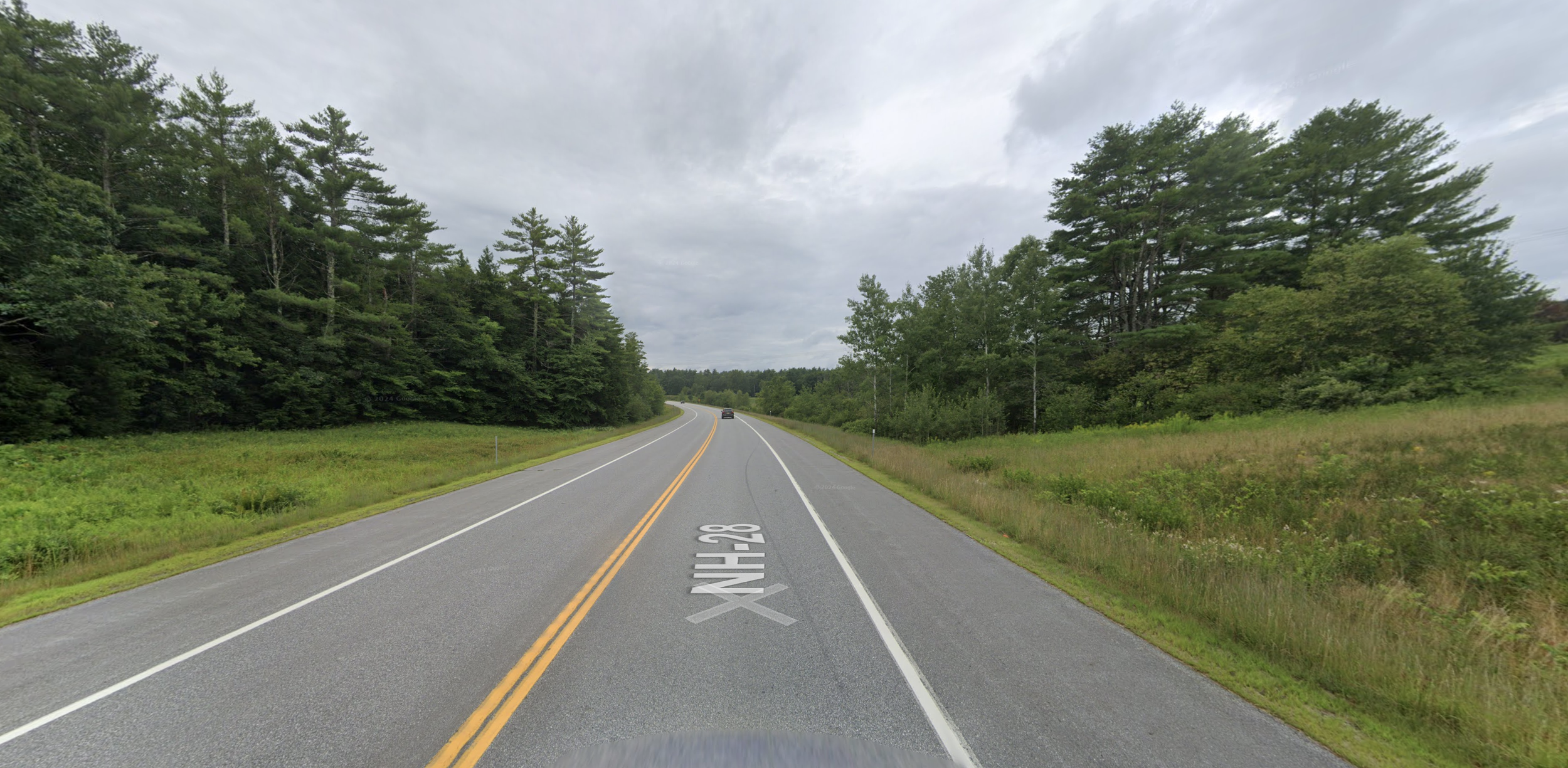
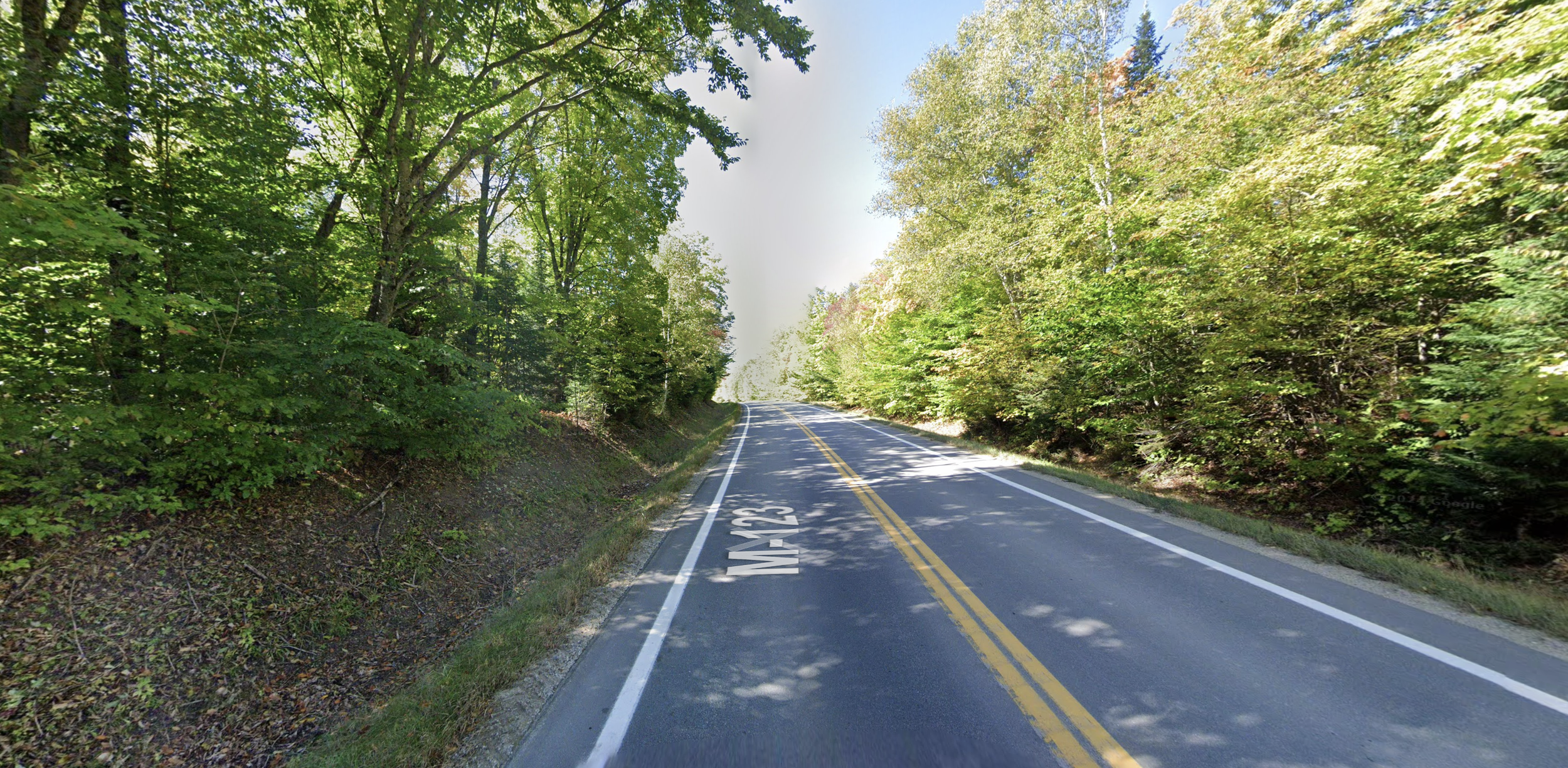
- Michigan on a New Hampshire round (721 miles)
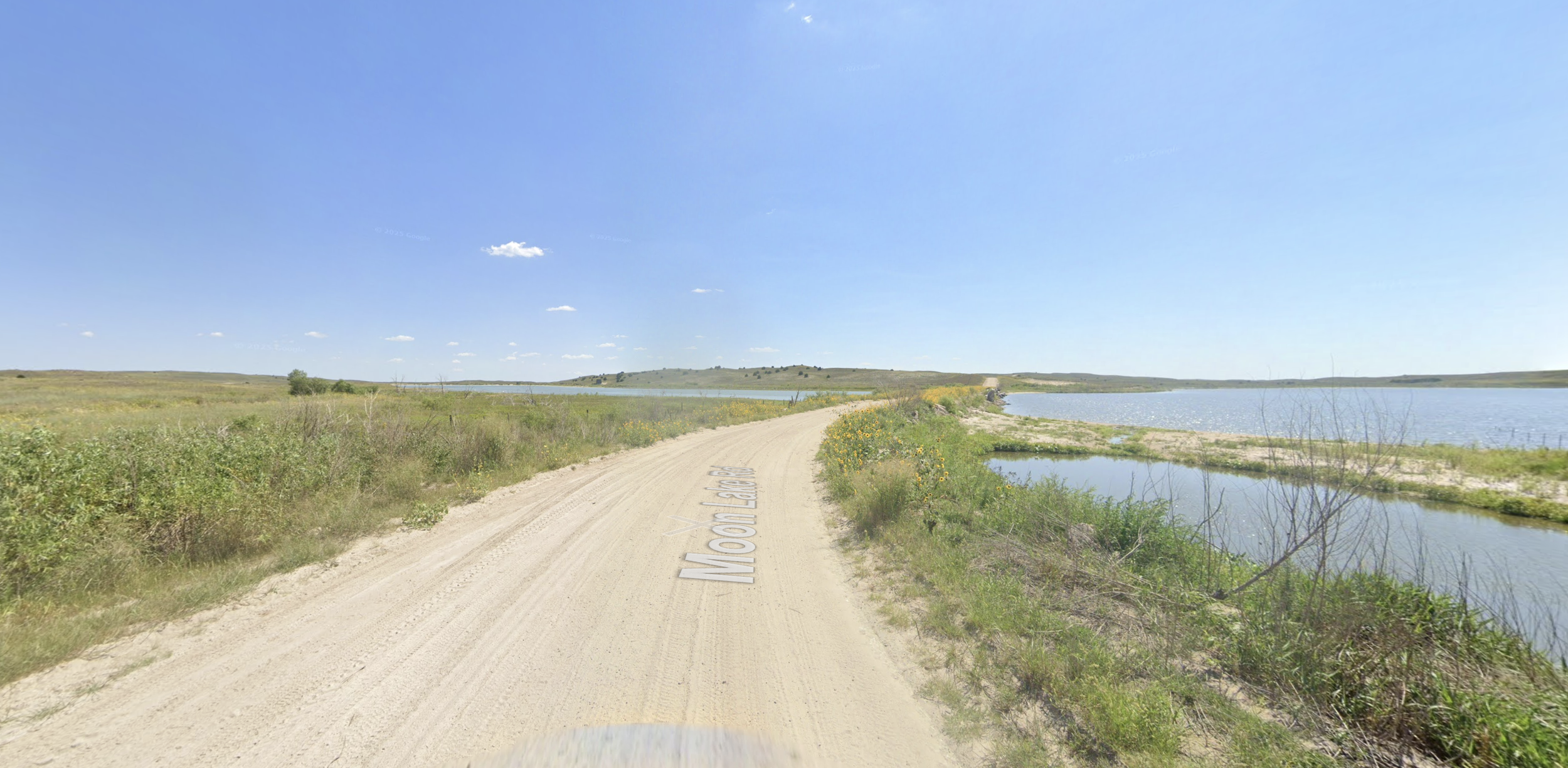
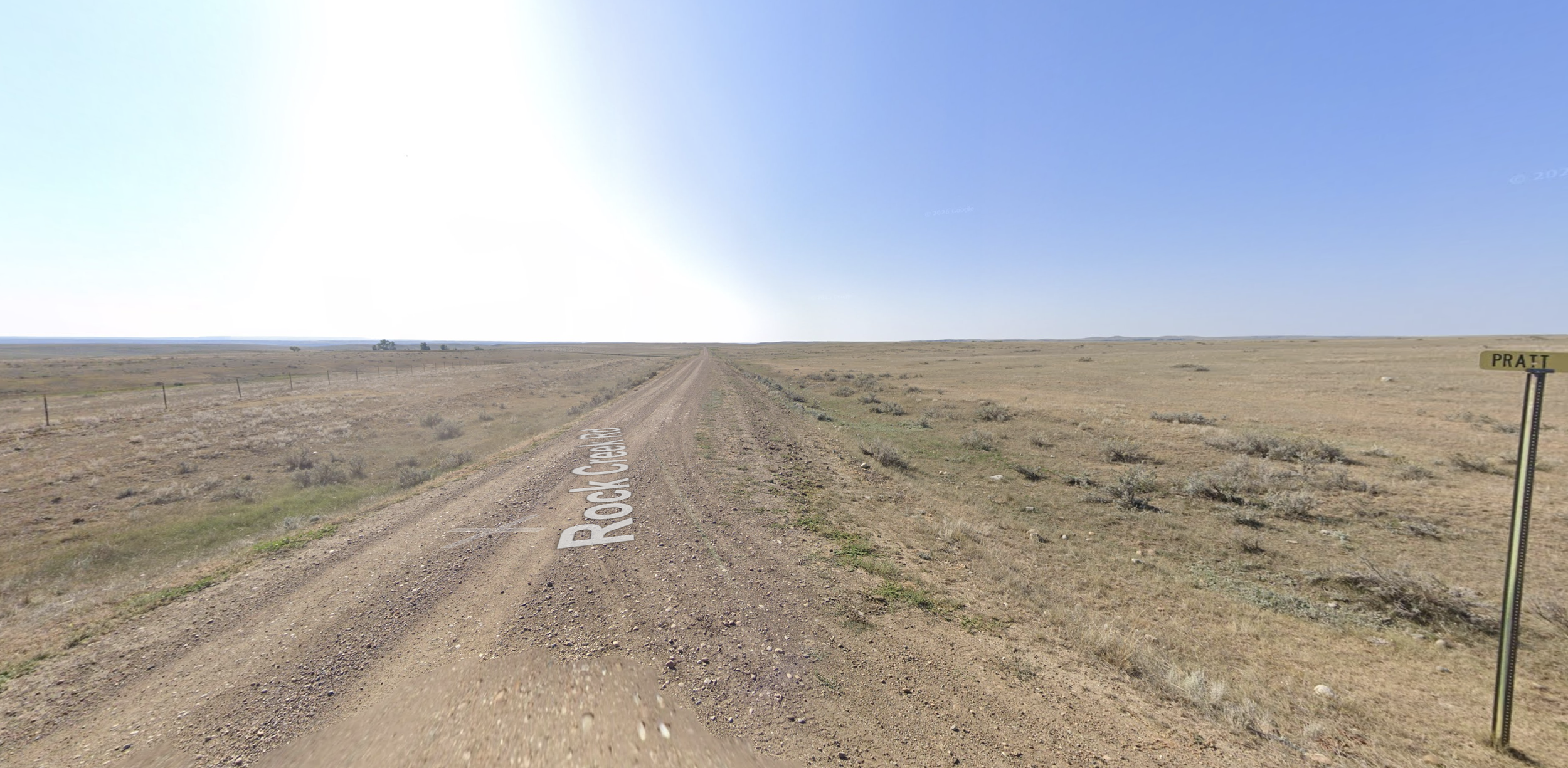
- Montana on a Nebraska round (562 miles)
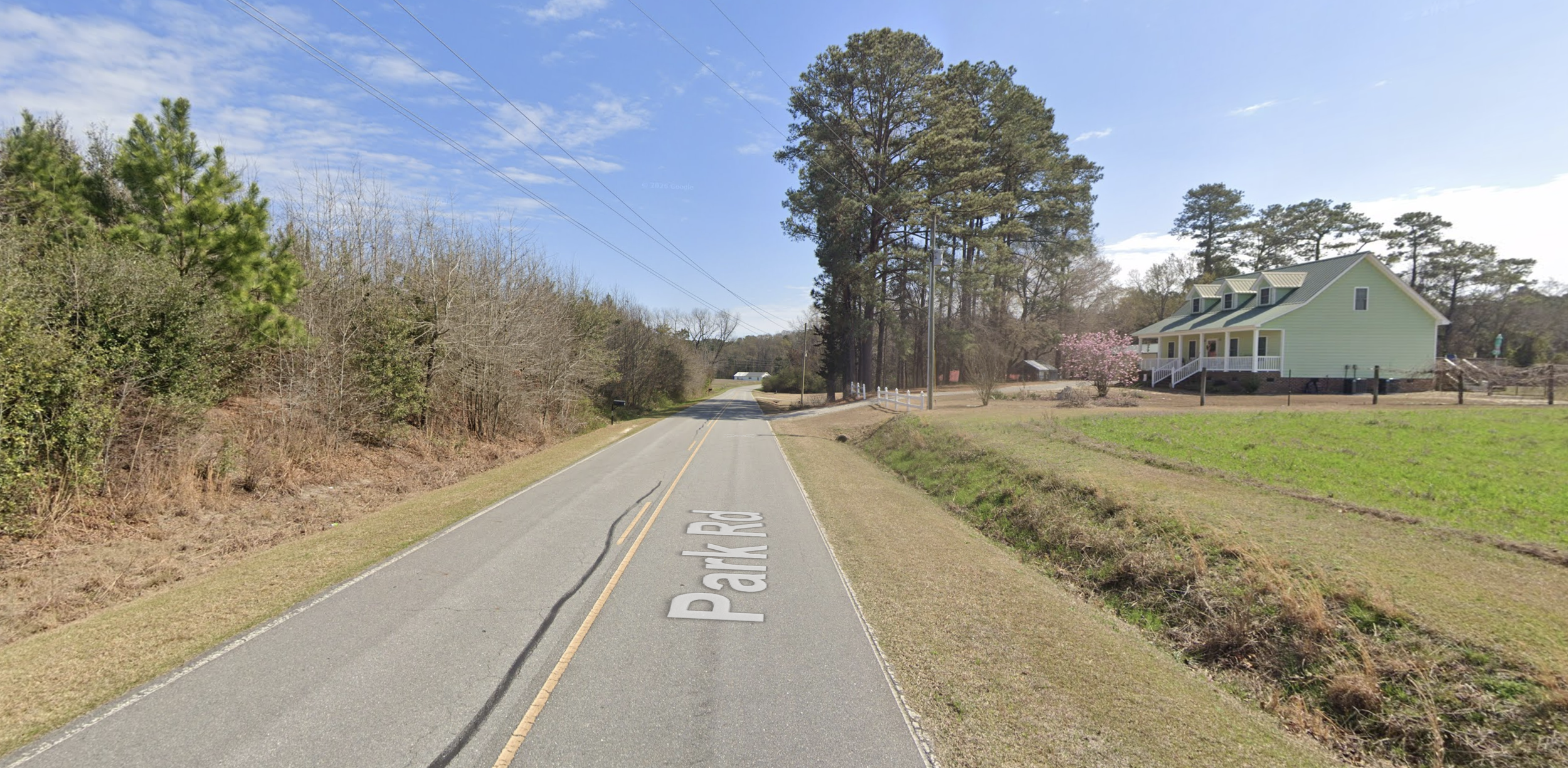
- Mississippi on a North Carolina round (676 miles)
At first I looked for the countries I was missing most often and found Slovakia topped the list — I only got it right 38% of the time.
But most of my Slovakia misses landed next door — Czechia, Poland, Romania, Hungary, Croatia. Near-misses like that don't cost much in a duel.
Instead of ranking countries by miss rate I ranked them by blunder rate: guesses off by 500 miles or more.
Many of these countries appear so infrequently that I removed them from the analysis.
I sorted the remaining countries by how many times they appeared in a duel.
The top eight countries – United States, Brazil, Russia, India, Australia, Canada, Mexico, Indonesia – accounted for 40% of every location I saw in a duel.
When I analyzed my blunders in these countries I found that I was correctly identifying the country most of the time, just guessing badly within it.
I got Brazil 94% of the time and still blundered 30% of Brazil rounds.
| Country | Correctly identified country | Blunder rate |
|---|---|---|
| USA 🇺🇸 | 96% | 18% |
| Brazil 🇧🇷 | 94% | 30% |
| Russia 🇷🇺 | 92% | 30% |
| India 🇮🇳 | 98% | 13% |
| Australia 🇦🇺 | 97% | 25% |
| Canada 🇨🇦 | 90% | 24% |
| Mexico 🇲🇽 | 89% | 22% |
| Indonesia 🇮🇩 | 88% | 30% |
In Geoguessr you worry about wrong-country blunders, like sending Brazil on Thailand.
But the data showed that although wrong-country blunders hurt, they were relatively rare.
For example nearly all my Colombia blunders were guesses in Mexico or Brazil.
But across the 12,710 guesses I analyzed, I only misidentified Colombia 30 times.
On the other hand correct-country blunders were just as damaging, and more common.
I knew big countries mattered more — obviously, the bigger the country, the more chances to blunder — but seeing the numbers was reassuring.
For most of 2025, I studied almost nothing but Canada, USA, Mexico, Brazil, Russia, India, Indonesia, and Australia – along with Europe, which I treated as one country. Each week, I chose one country and spent my entire 45-minute morning window on it. I played practice maps on repeat and document coverages. Then, the next week, I moved on.
The hard part was not overreacting to bad guesses in duels.
A year into playing, I’d make mistakes that I thought I had corrected months ago, like sending Sri Lanka on a Cambodia round. I’d forget trucks in Denmark had yellow plates. I’d lose five duels in a row and drop 75 elo.
Then, fueled by self-doubt, I'd fixate on whatever small country had just burned me — Tunisia, Israel, Senegal — or whatever big country I blundered despite practicing, and think: maybe I'm doing this completely wrong. It reminded me of golf. There were so many ways to drop points that picking one to work on felt futile.
Having a short memory was essential. And this is where I had another advantage in disguise. Since I only played duels from 4:30 to 5:00pm on weekdays – at 5:00 sharp I had to go pick up my kids – I never had time to chase my losses or ride a win streak, both of which would have wrecked me. Chasing losses meant guessing fast just to make the bad feeling go away. Riding a streak meant skimming the landscape instead of reading it.
At 5:00 I closed the laptop either way. Then the next morning, whatever had happened the day before, I practiced whatever country I was working on that week.
A few months into the eight-country strategy, I noticed something about my blunders in the big eight: I was rarely getting the country wrong. I’d correctly identify Brazil, then miss by 500 miles inside it — a sugar cane plantation in Alagoas mistaken for São Paulo, or the reverse.
| Country | Correctly identified country | Blunder rate |
|---|---|---|
| USA 🇺🇸 | 96% | 18% |
| Brazil 🇧🇷 | 94% | 30% |
| Russia 🇷🇺 | 92% | 30% |
| India 🇮🇳 | 98% | 13% |
| Australia 🇦🇺 | 97% | 25% |
| Canada 🇨🇦 | 90% | 24% |
| Mexico 🇲🇽 | 89% | 22% |
| Indonesia 🇮🇩 | 88% | 30% |
The data supported this story. In fact, correct-country blunders were more common than incorrect-country ones. And since many involved two regions that looked similar, they didn’t feel like blunders. They felt like hard calls: I’d correctly narrow down the location from hundreds of possibilities, then guess wrong by a coin flip.
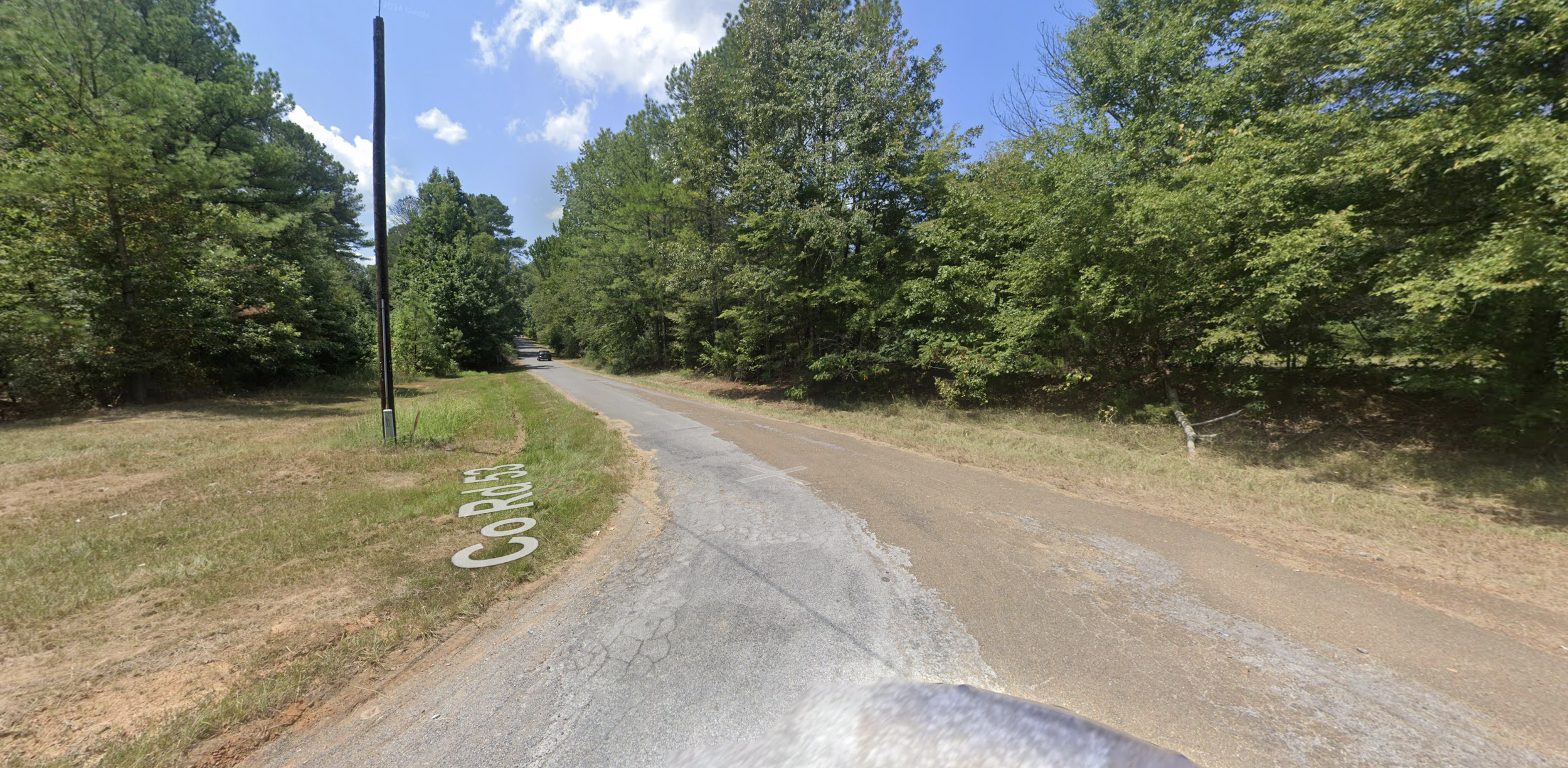
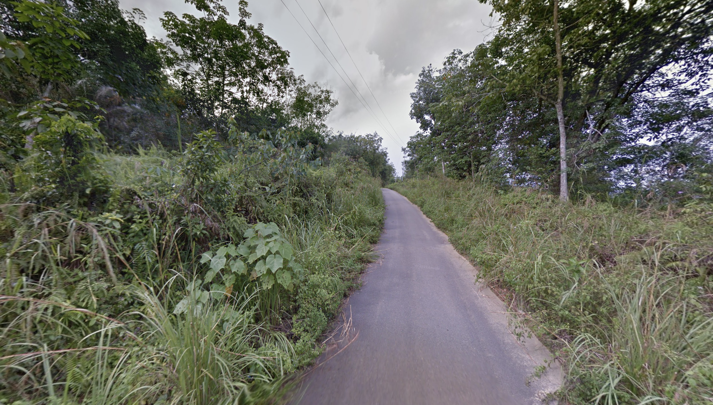
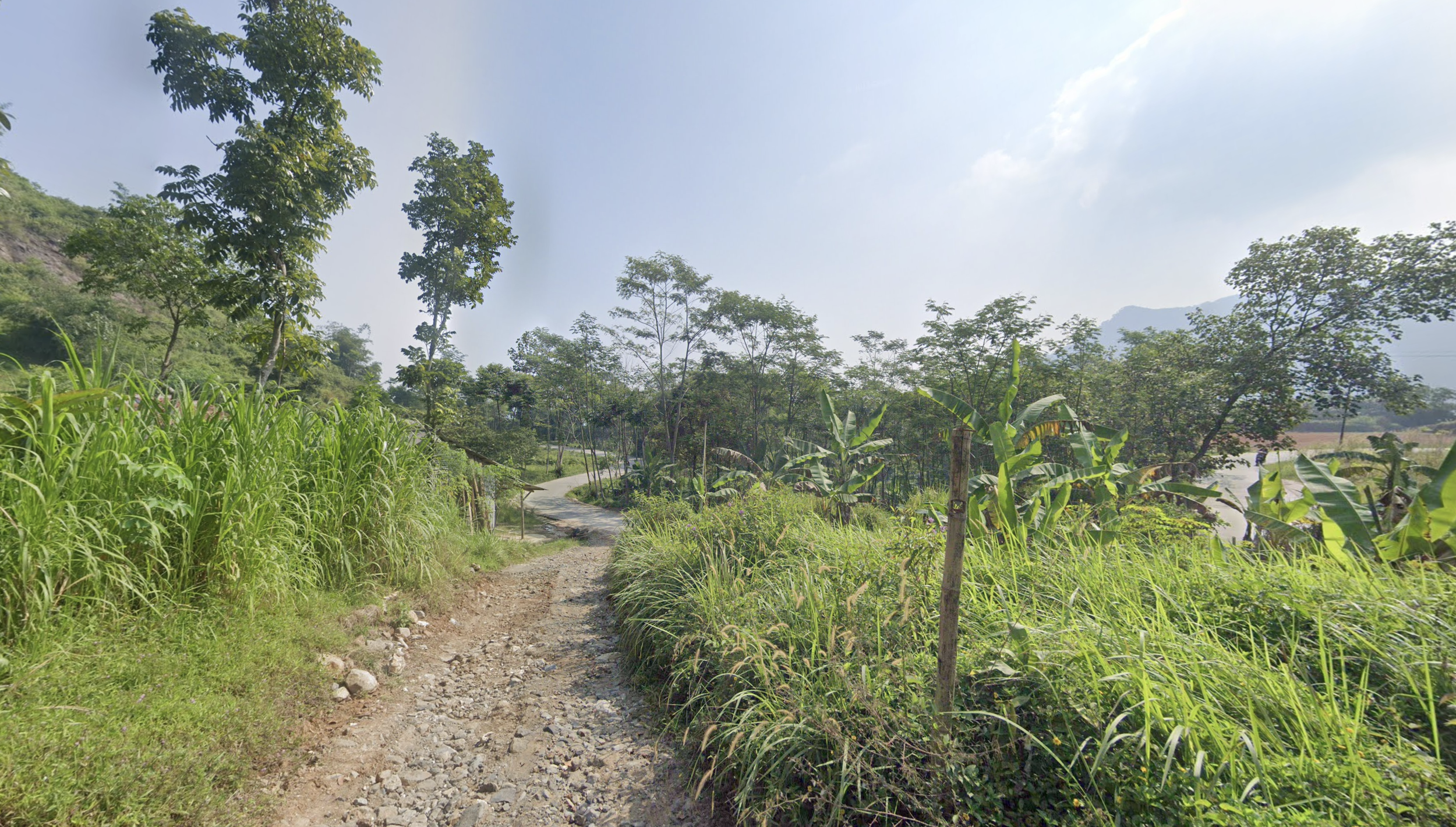
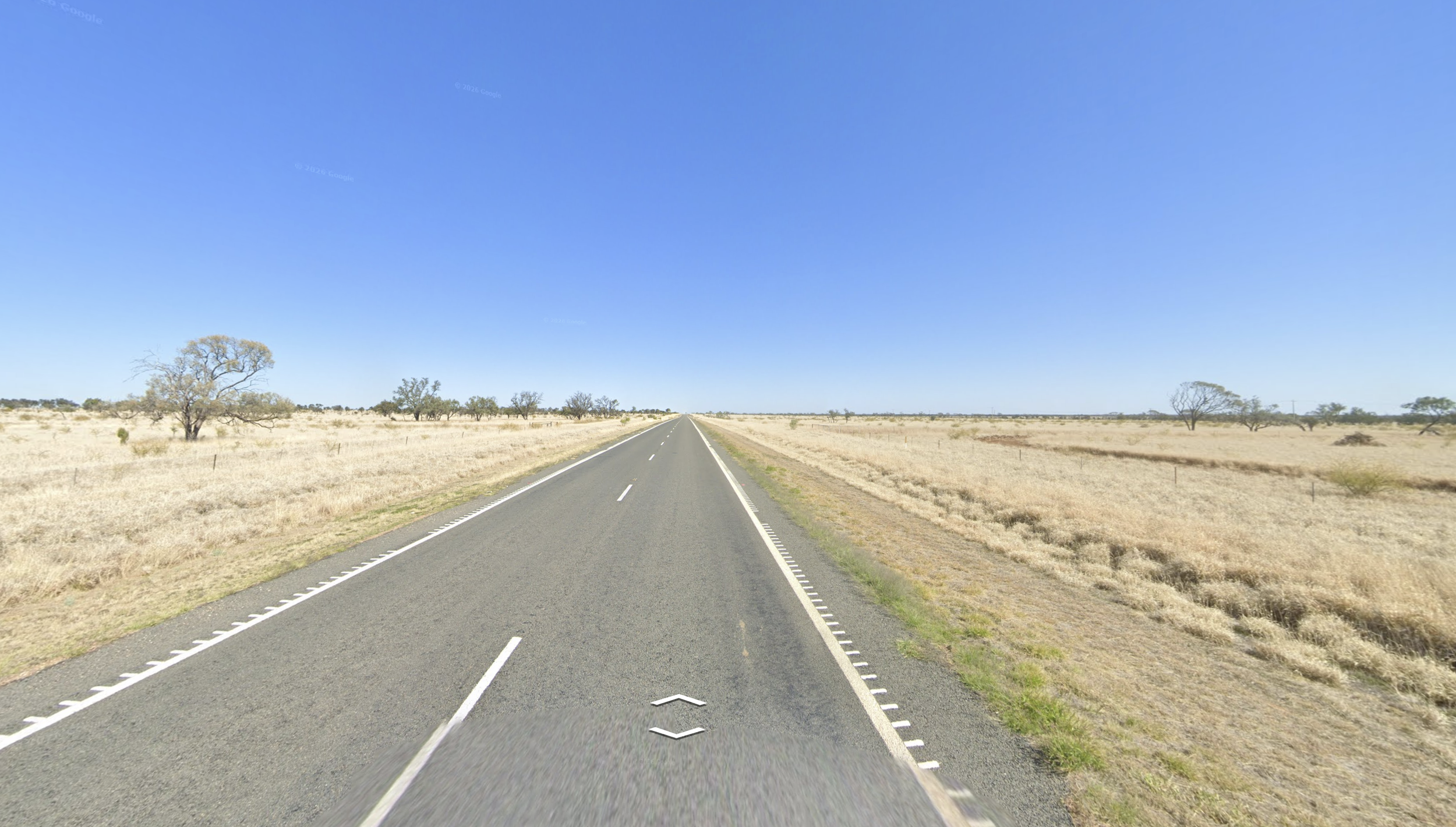
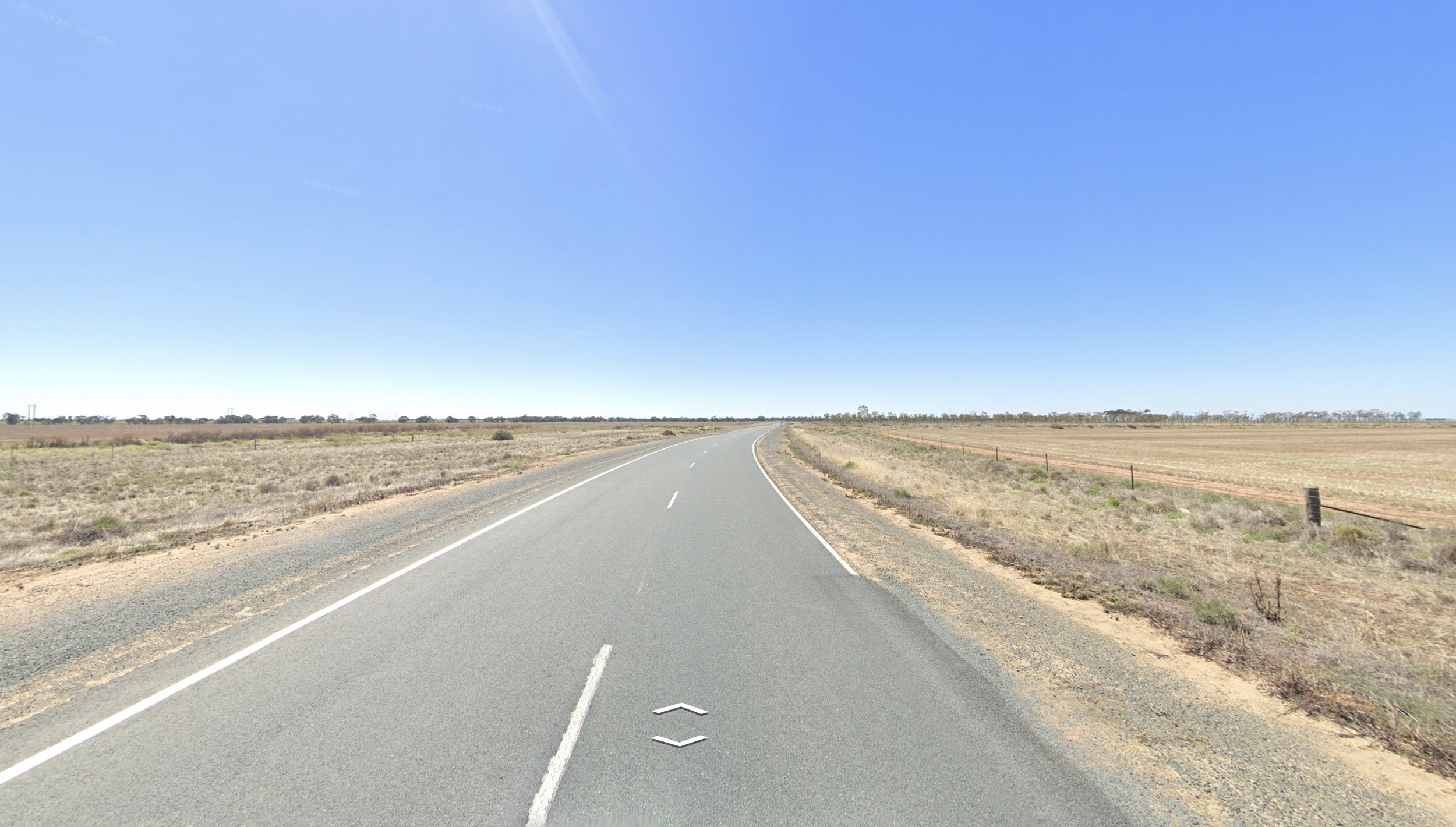
Here’s a closer look at three examples in the US, Indonesia, and Australia.
Michigan on a New Hampshire round (721 miles).
West Java on a West Sumatra round (634 miles).
Victoria on a Queensland round (775 miles).
I knew big countries mattered more — obviously, the bigger the country, the more chances to blunder — but seeing the numbers was reassuring.
For most of 2025, I studied almost nothing but Canada, USA, Mexico, Brazil, Russia, India, Indonesia, and Australia – along with Europe, which I treated as one country. Each week, I chose one country and spent my entire 45-minute morning window on it. I played practice maps on repeat and document coverages. Then, the next week, I moved on.
The hard part was not overreacting to bad guesses in duels.
A year into playing, I’d make mistakes that I thought I had corrected months ago, like sending Sri Lanka on a Cambodia round. I’d forget trucks in Denmark had yellow plates. I’d lose five duels in a row and drop 75 elo.
Then, fueled by self-doubt, I'd fixate on whatever small country had just burned me — Tunisia, Israel, Senegal — or whatever big country I blundered despite practicing, and think: maybe I'm doing this completely wrong. It reminded me of golf. There were so many ways to drop points that picking one to work on felt futile.
Having a short memory was essential. And this is where I had another advantage in disguise. Since I only played duels from 4:30 to 5:00pm on weekdays – at 5:00 sharp I had to go pick up my kids – I never had time to chase my losses or ride a win streak, both of which would have wrecked me. Chasing losses meant guessing fast just to make the bad feeling go away. Riding a streak meant skimming the landscape instead of reading it.
At 5:00 I closed the laptop either way. Then the next morning, whatever had happened the day before, I practiced whatever country I was working on that week.
A few months into the eight-country strategy, I noticed something about my blunders in the big eight: I was rarely getting the country wrong. I’d correctly identify Brazil, then miss by 500 miles inside it — a sugar cane plantation in Alagoas mistaken for São Paulo, or the reverse.
| Country | Correctly identified country | Blunder rate |
|---|---|---|
| USA 🇺🇸 | 96% | 18% |
| Brazil 🇧🇷 | 94% | 30% |
| Russia 🇷🇺 | 92% | 30% |
| India 🇮🇳 | 98% | 13% |
| Australia 🇦🇺 | 97% | 25% |
| Canada 🇨🇦 | 90% | 24% |
| Mexico 🇲🇽 | 89% | 22% |
| Indonesia 🇮🇩 | 88% | 30% |
The data supported this story. In fact, correct-country blunders were more common than incorrect-country ones. And since many involved two regions that looked similar, they didn’t feel like blunders. They felt like hard calls: I’d correctly narrow down the location from hundreds of possibilities, then guess wrong by a coin flip.
Here’s a closer look at three examples in the US, Indonesia, and Australia.
Michigan on a New Hampshire round (721 miles).
West Java on a West Sumatra round (634 miles).
Victoria on a Queensland round (775 miles).
So I turned that insight into a practice plan. For most of 2025, I studied almost nothing but Canada, USA, Mexico, Brazil, Russia, India, Indonesia, and Australia – along with Europe, which I treated as one enormous country.
Each week, I chose one country and spent my entire 45-minute morning window on it. I played practice maps on repeat and document coverages. Then, the next week, I moved on.
The best GeoGuessr players in the world are generalists — equally dangerous in Chile, Turkey, South Africa, Japan, Thailand, wherever the game sends them. A curriculum built around eight countries sounds like a good way to become mediocre at the other ~80.
I knew this going in, so I didn't actually go all-in on Brazil during Brazil week, or the US during US week. After every duel, win or lose, I still logged whatever I'd missed — insulator ridges in southern Thailand, snow coverage in western Ontario, wind farms near Gqeberha, South Africa.
I wasn't trying to become world-class — only better than whoever I was playing in a duel, and better than I'd been a month earlier. In the GeoGuessr community, everyone idolizes the World Cup players. Most competitive players are chasing that stage, whether they'd say so or not. I had a family and a job so I was fine never getting there. My goals were smaller, and easier to hit.
Average distance from the correct location, eight countries, 2024–2026.
The plan worked. My ELO climbed throughout 2025, from 1,321 in January to 1,660 in December, good for about 30th in the United States and 400th globally. Russia never got easier. But on balance, across the eight countries, I was blundering less than I used to. Going into 2026, I was squarely in the Champion division and still climbing at my own pace.
It would not stay that way.
Chasing 1,850
On New Year's Eve 2025, I set a goal: an ELO of 1,850, roughly top 250 in the world at the time. It felt attainable, and in March I got within one win of it three times. I was sure I'd hit it within days. I'd started planning 1,900. Maybe 2,000.
Then came the most frustrating stretch of the whole experience. Between the weeks of March 20 and March 27, I dropped to 1,769. I finished the third week of May at 1,702, a rating I'd already held six months earlier. At one point I dipped into the 1,660s. Claude analyzed my stats and told me the slump was “statistical variance.” But if a single duel loss stings, a losing streak feels like a referendum on your self-worth.
Somewhere in this stretch, something became clear: this needed to end. I'd successfully swapped YouTube for GeoGuessr nearly two years earlier. Now I felt pressure. Forty-five minutes with coffee had become a stage I graded myself on every morning. I made myself a promise: hit 1,850, and I'd retire from trying.
Then, in June, as if to set a hard deadline on my goal, GeoGuessr announced — with about two weeks' notice — that it was resetting everyone's ELO to correct for inflation. My rank would hold, but "hit 1,850" was about to become "hit 1,175," a number that meant nothing to me. I wanted 1,850, the one I'd been chasing for six months.
Nine days from the reset, I caught fire. I played 22 duels and won 16. Two days before the reset, on Friday, June 26th, I'd pushed my ELO to 1,794. The reset was landing at midnight on Sunday the 28th. If I wanted to reach 1,850, I had to do something I'd never done before: play on the weekend.
That night, after the kids and my wife went to sleep, I went into our home office and fired up the queue. I played four duels, won three, and climbed to 1,834. What happened next is one of my favorite moments I've ever had as a gamer.
My opponent is Mumani, a 1,910-rated player from Japan. The house is quiet. Everyone's asleep. It's just me, a laptop, and a stranger on the other side of the world who's about to decide whether I hit my number. Thirteen rounds. The lead changes hands more than once. I stop tracking the score around round eight and just play.
I win. +20 ELO. 1,834 to 1,854.
Every round is below if you want to click through.
The first year and a half I played GeoGuessr, I played alone. The game is built for that: you practice alone, you duel strangers.
It doesn't have the mass appeal of chess or crossword puzzles, so the parents I hung out with at the playground were nice enough to nod along while I explained what a blunder was, or a 5k, or South Dakota pavement. But they weren’t asking follow-up questions either.
In July 2025, GeoGuessr introduced clubs — small groups, capped at 30 people. I joined USAG, short for "USA GeoGuessrs." For the first time I was talking to people who also cared about palm trees that show up in Sulawesi but not Sumatra. I picked up more useful clues in a few weeks of casual chat than I had in months alone.
The club confirmed my intuition that the game was dominated by people in their twenties — unattached, with more hours a day to give it than I had — but I did meet another dad with young kids. What caught me off guard was the support. These people only existed to me as usernames, but the slump, the goal-chasing, the practice strategy — they'd all been through it too.
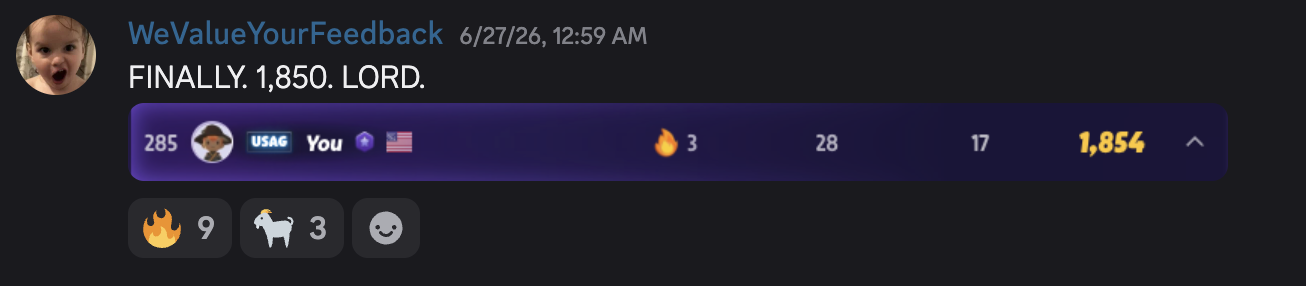
So when I hit 1,850, the first thing I did was open the USAG Discord and post a screenshot. I got nine fires and three goats. Nice.
The following night, the ELO reset hit. The number I’d stared at every morning for six months turned into a different number and stopped meaning anything to me. Which was fine. I’d already gotten what I came for.
Life after 1,850
These days I still play. I just don't spend my mornings grinding. New countries have recently been added — Georgia, Bosnia, Kosovo — with rumors of Kuwait and Moldova coming soon. These are the equivalent of expansion packs, and I'll keep up. But if I open GeoGuessr now, it's because I feel like it.
There are two things this game left me with. The first is the strange ability to picture, anywhere in the world with Street View, exactly where someone means when they say home.
Last week a TaskRabbit guy came to fix our AC. His name was Ivan, and when I asked where he was from, we ended up talking about the area around Ulan-Ude, in Buryatia, a part of Siberia most people have never heard of. Drive southeast of Ulan-Ude for half a day or so and you'll hit a location that appeared in my final duel, the one I guessed within 440 yards (round 7, image 13).
The second is proof that 45 minutes, used on purpose, beats an open afternoon used carelessly. Younger and childless, I would have binged GeoGuessr and burned out before reaching the Champion division.
These days, I complain about my day-to-day parenting duties, but my kids didn’t hinder this hobby. They organized it. When you have kids, your world shrinks. You always know where you are.